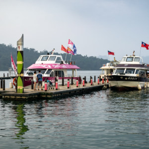
This post is the final entry in a series documenting several days of riding around Nantou in October 2015. On the last morning of this trip I woke in Puli, close to the geographic center of Taiwan. I only had to return the scooter to the rental shop in Taichung sometime after nightfall so I decided to take a more circuitous route and check out many sights along the way. After a quick breakfast I headed south, briefly stopping by the shores of the majestic Sun Moon Lake (日月潭, covered in the previous entry in this series), and ascended a winding mountain access road leading into Xinyi, one of several majority Taiwanese Indigenous districts in this landlocked county.
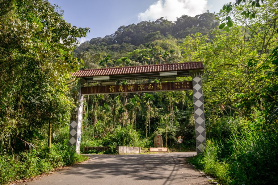
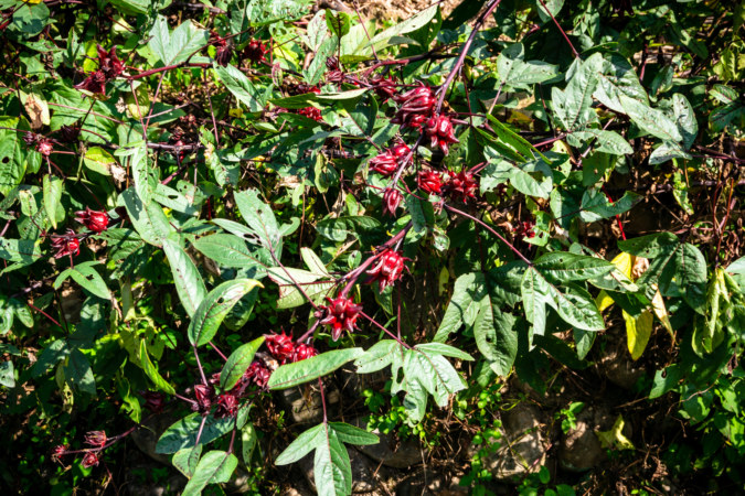
Tánnán Village (潭南村) is the first village south of the lake—and its name in Chinese means exactly that, literally “lake south”. It is home to the eponymous Tannan community (潭南部落), part of the Takibakha group (卡社群) of the indigenous Bunun people1. The community is scattered along County Road 63, which twists its way down the mountainside to the river valley below. Here I made a pitstop to observe local residents harvesting the fleshy pink fruits of Hibiscus sabdariffa, the roselle plant (洛神花). I have become quite fond of the roselle tea commonly found in night markets around Taiwan so it was interesting to learn where it is normally cultivated.
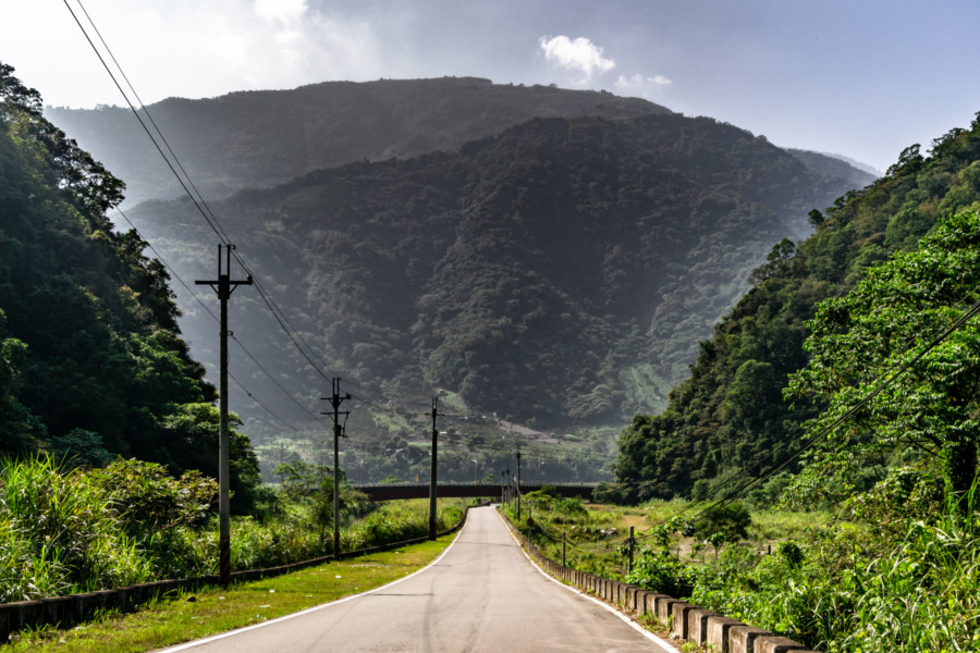
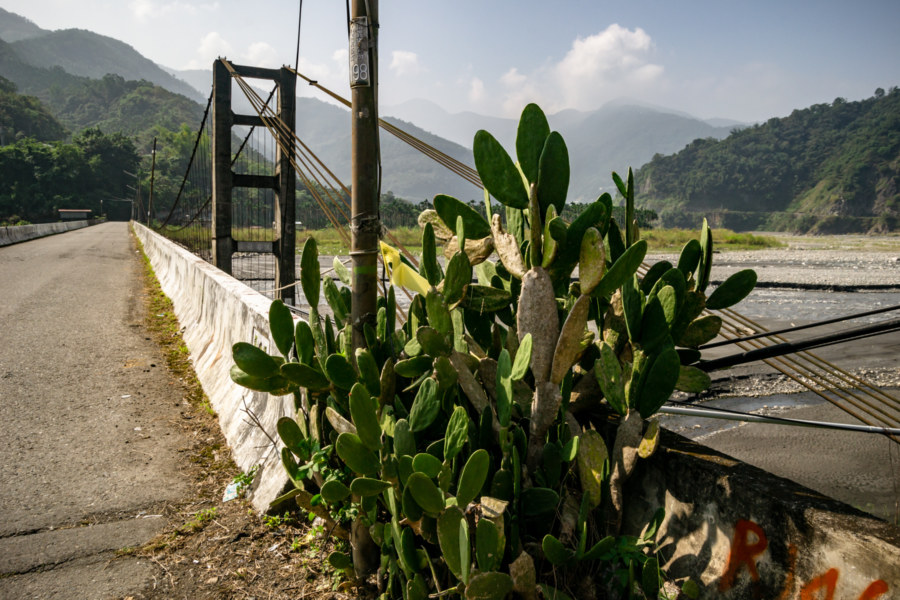
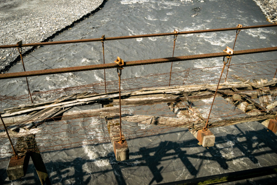
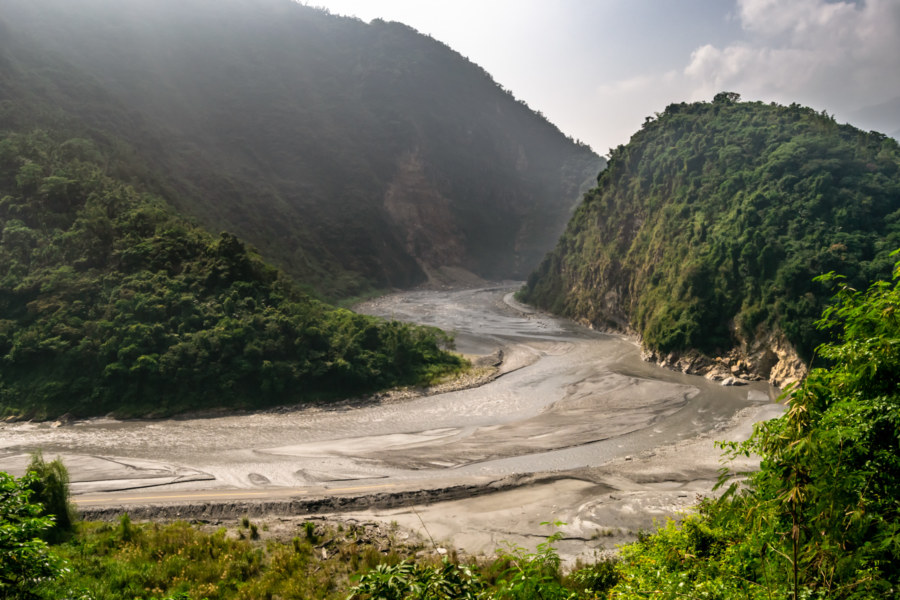
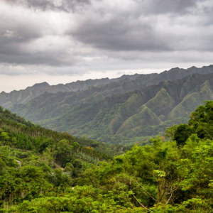
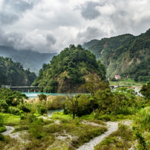
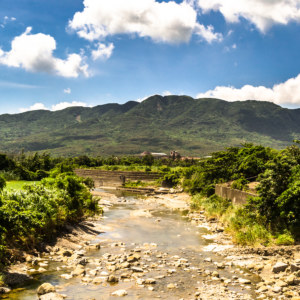
County Road 63 merges with Provincial Highway 16 on the north bank of the sluggish Zhuoshui River, the longest in the nation at 186 kilometers in length. Heading west toward the coastal plains, I soon encountered the remains of the Qīngyún Suspension Bridge (青雲吊橋), which dates back to 1980. The river appears placid in these photos but disastrous landslides and floods are not uncommon in this part of the country, especially when typhoons sweep over the central mountains. Details are scant, but it would appear as if this particular bridge wasn’t destroyed in any disaster; it was simply replaced by a newer, wider bridge, and dismantled not long after I passed through. I’m not sure what explains the dilapidated appearance—perhaps it was in the process of being stripped down when I passed through?
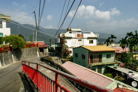
After following the winding road on the opposite bank of the river I arrived at Rénlún Village (人倫村), a Bunun settlement of the Takbanuaz group (巒社群)2. I wasn’t able to uncover too much about the history of the village, but it seems likely this Indigenous community was resettled in this vicinity here sometime in the 1920s or early 1930s, and the village, now perched on a hillside, occupies a site chosen in 1949.
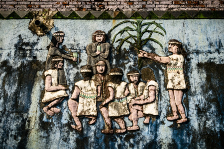
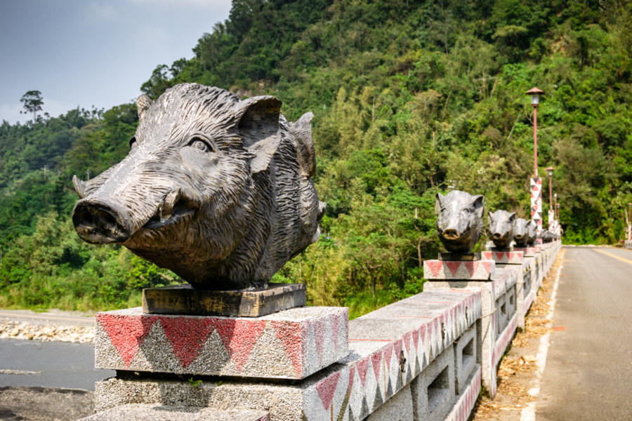
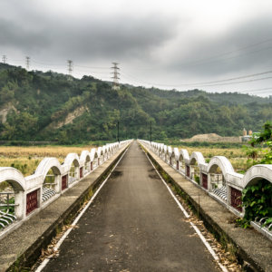
Without realizing it, I had entered the village from the far side; soon I found myself at the foot of the distinctive Rénlún Bridge (人倫橋), ordinarily the first glimpse of the eponymous village for visitors and returning residents. This bridge, which also spans the Zhoushui River, is adorned with dozens of sculptures depicting a double-headed Taiwanese wild boar (shānzhū 山豬, formally Sus scrofa taivanus), an icon of Bunun culture3.
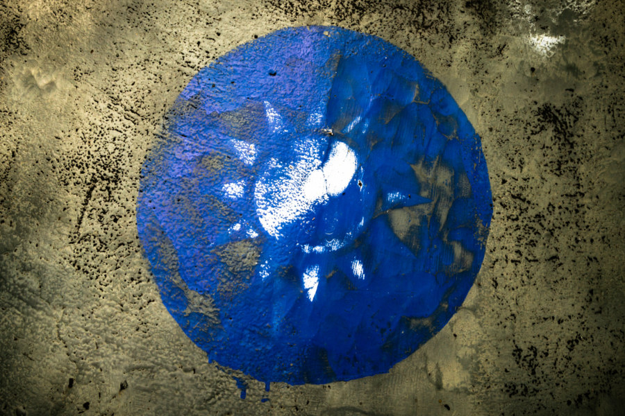
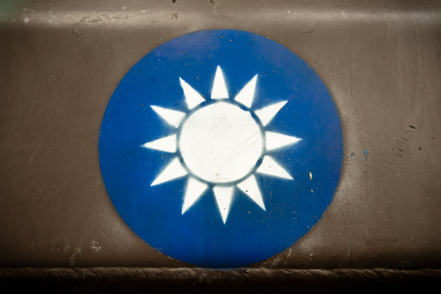
At the foot of this bridge one will also find an old M48 Patton tank (巴頓坦克), specifically the M48A3 model, which was either made or retrofitted here in Taiwan. These tanks were probably decommissioned in the 1980s and I haven’t the slightest idea what this one is doing here. Observe the faded emblem; this is the Blue Sky with a White Sun (靑天白日旗) of the Kuomintang and, by extension, the ROC Armed Forces.
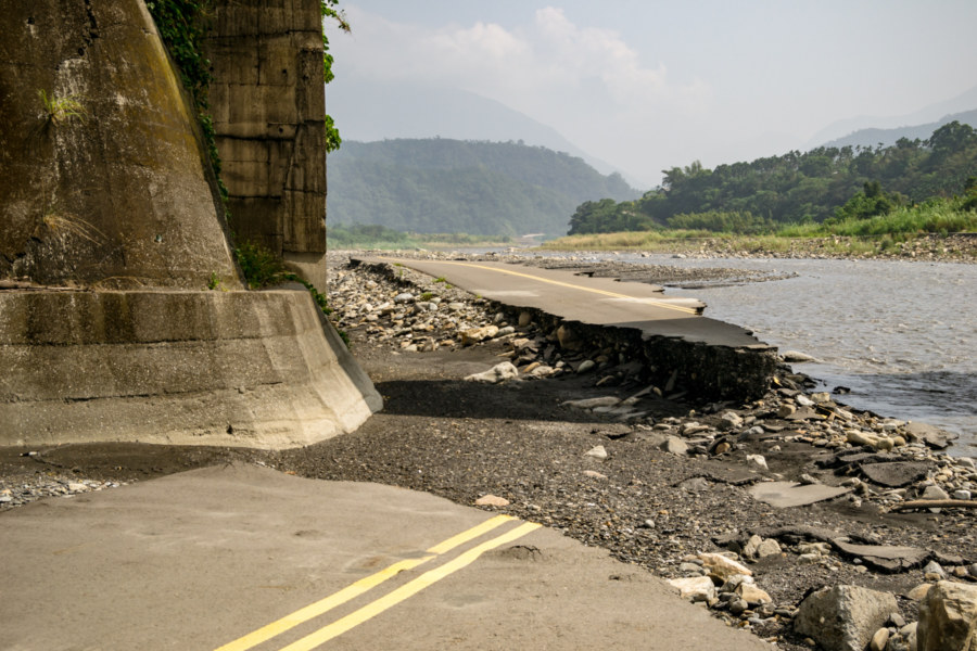
While crossing the river I noticed something interesting along the northern shore. Descending along a small access point on the far side, I went to investigate, and found the heavily eroded and fragmented remains of a paved road running along the riverside. Sleuthing around on Google Maps reveals several other sections of roadway along this stretch of river, and the presence of yellow dividing lines suggest it was open to regular traffic at some point. I surmise this was a temporary bypass road constructed in the aftermath of Typhoon Morakot (颱風莫拉克) in 2009 while repairs were conducted on the main highway, but this is mere conjecture. It also could have been constructed for gravel extraction; there is a large mining operation around the next bend in the river.
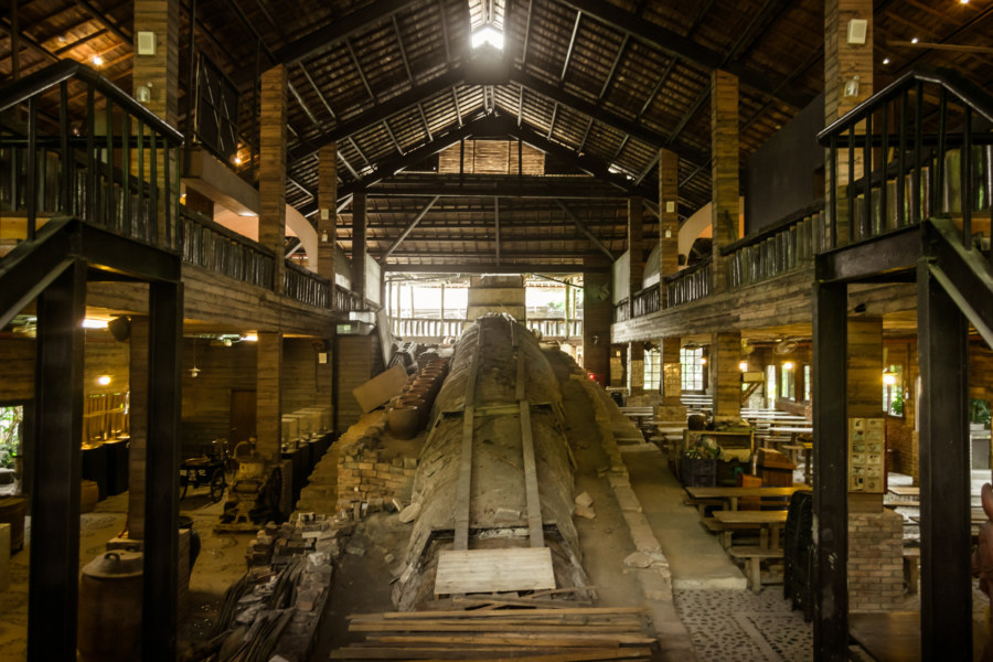
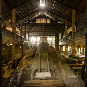
Back on Highway 16, I continued into Shuili, but made a brief detour to scope out the Shuili Snake Kiln, partly because of the intriguing name. This kiln was firing pottery as far back as 1927 and derives its moniker from its serpentine shape, which channels heat up the body of the “snake”. Unfortunately the kiln collapsed in the devastating 921 Earthquake of 1999, a disaster that left scars all over this part of the country. The kiln was rebuilt and transformed into a tourist attraction in the years that followed, almost certainly with government assistance. I ended up devoting an entire post to it, so follow this link if you’d like to read more about the snake kiln!
Shuili is home to approximately 18,000 residents, most of whom are concentrated in a sizeable settlement sprawling along a river terrace on the north side of the Zhoushui River. Although it is the gateway to Sun Moon Lake and parts beyond, few tourists stop here for anything other than a quick snack, typically bawan (肉圓). Historically, Shuili was an important center of the camphor and lumber trades, and a staging point for the many hydroelectric projects previously discussed in this series.
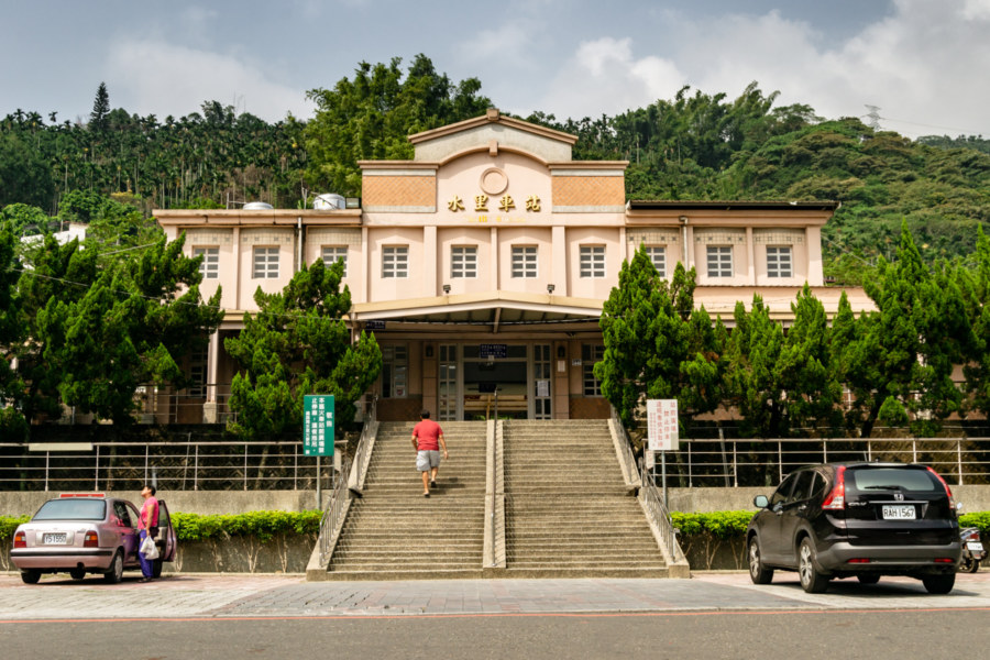
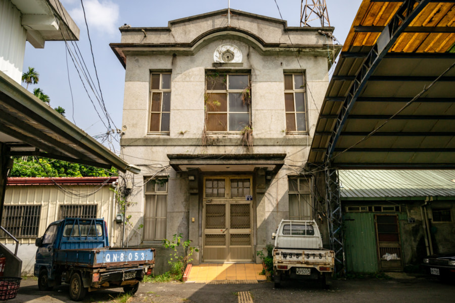
One legacy of all this industrial activity is the Jíjí Line (集集線), a railway spur completed in 1922. It branches off the West Coast Line (縱貫線) at Ershui in Changhua and terminates at Chēchéng Station (車埕車站), approximately 2 kilometers into the mountains north of Shuili Station (水里車站). The railway station building itself is not so old, but just next door you’ll find the Japanese colonial era Shuili Police Substation (水里分駐所). It was designated a heritage property in 2015 and now awaits restoration4.
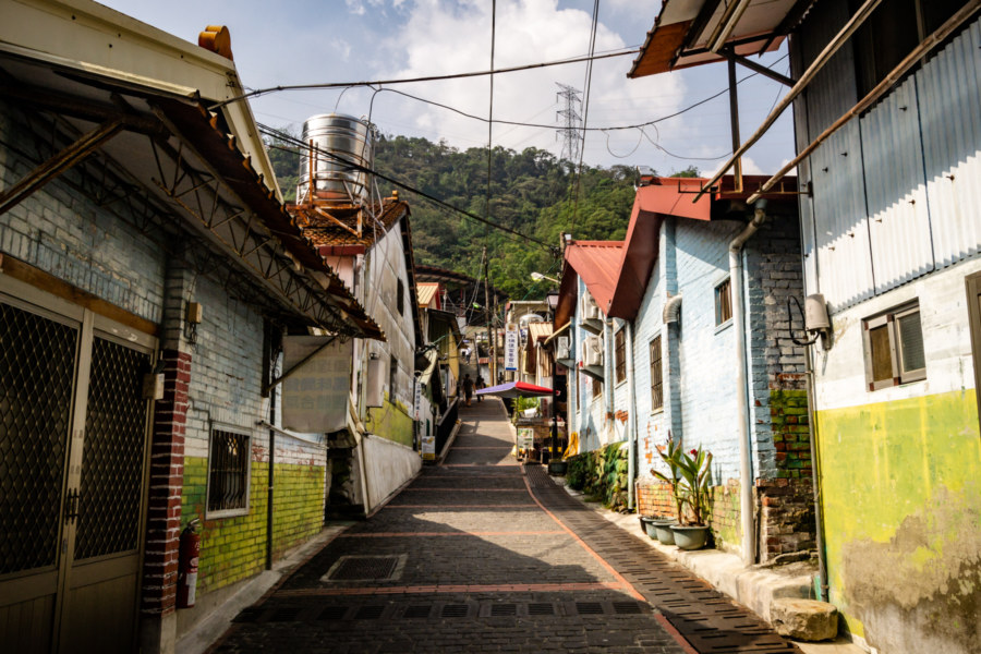
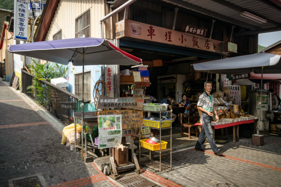
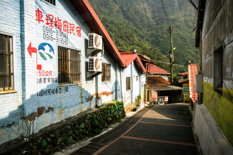
Since I was making good time I made a small detour into the mountains to grab lunch in Chēchéng Village (車埕村). My usual spot next to the railway station was closed so I wandered up Mínquán Lane (民權巷) and sampled a bento box at the Checheng Eatery (車埕小飯店). This shop is one of several offering wooden bento boxes, a throwback to when this was a company town dominated by Zhènchāng Lumber Industries (振昌木業), which relocated most of their operations to Fengyuan in the late 1980s. The village was rehabilitated as a major tourist attraction in the early 2000s and now welcomes hundreds of thousands of visitors every year5.
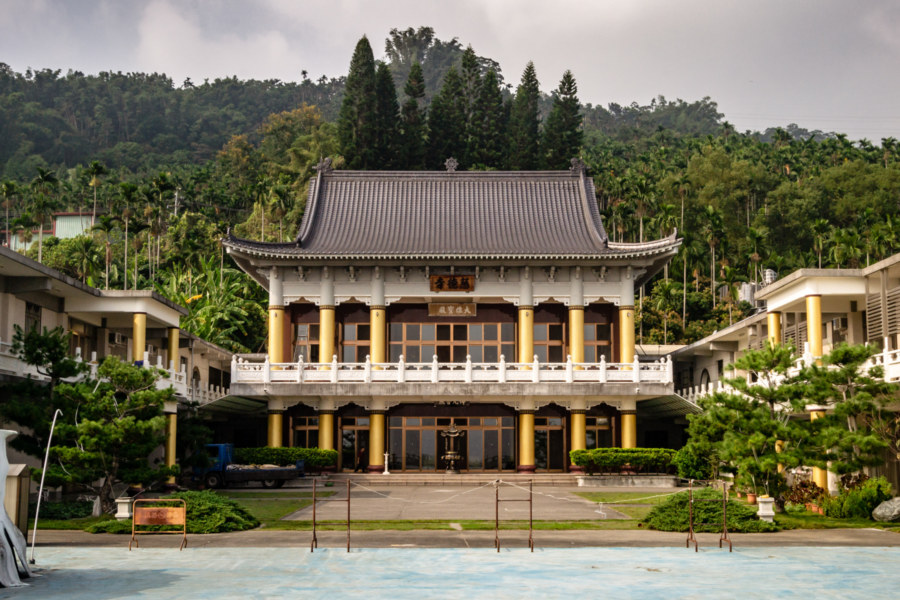
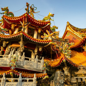
I exited Shuili by way of County Road 27, an older route that follows the contours of the rolling hills overlooking the ever-present river. I noticed an interesting páifāng (牌坊, gateway) while passing through an area known as Yóuchēkēng (油車坑) and elected to take a closer look. This turned out to be the scenic Cídé Monastery (慈德寺), a beautiful Buddhist-style temple attached to one of only a handful of crematoriums in this part of the country. It has quite a history, and has been in business at this location since the early 1960s6. It was one of countless structures damaged beyond repair in 1999 and was completely rebuilt, hence why it looks so new.
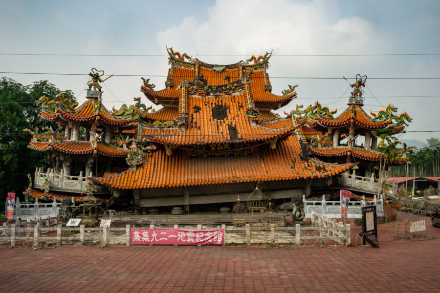
Descending into Jiji with an eye on the clock, I revisited Wǔchāng Temple (武昌宮), another temple destroyed by the big quake. It was founded in 1923 and moved to this site in 1990, after which construction began on a more modern reinforced concrete structure. Disaster struck mere months after it opened to the public in 1999 and the temple collapsed. Rather than clear the ruins the temple was preserved as a memorial—and an impressive new temple was constructed next door with the generous donations that came pouring in after 921. If you’re interested in seeing more of this collapsed temple (and its opulent replacement), follow this link.
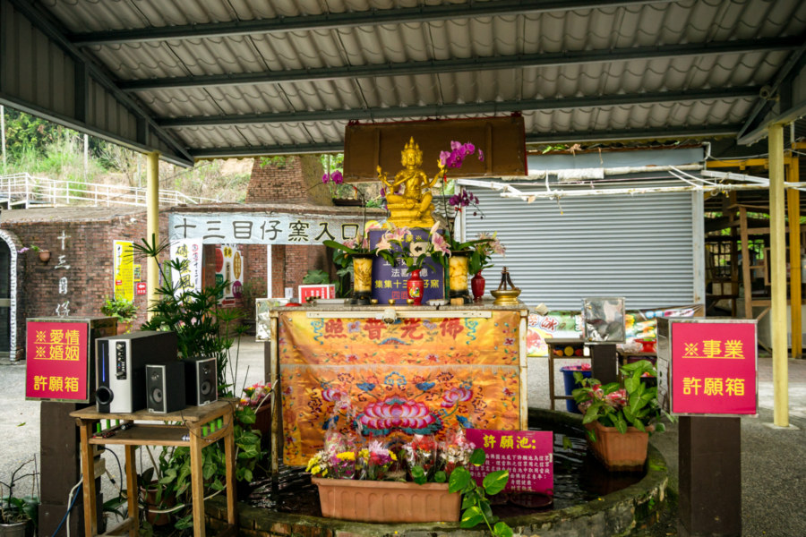
While exiting Jiji to the west I swung by the Thirteen Eye Kiln (十三目仔窯). Much like the Shuili Snake Kiln, this one was also destroyed by the 921 Earthquake, but it wasn’t reconstructed. You would be forgiven for assuming, as I did, that the body of the kiln was converted into a bunch of shops selling trinkets and souvenirs, but this is merely a structure inspired by the original kiln, which is little more than a pile of rubble off to one side. The site is quite extensive, however, and you’ll find a wild assortment of quirky shrines and novelty vendors in this tacky tourist trap7. I noticed one new feature since my last visit to the site: a shrine to the Four-Faced Buddha (四面佛), better known as Phra Phrom, a Thai incarnation of the Hindu deity Brahma. Such shrines have been sprouting up all over Taiwan in recent years, a consequence of the growing popularity of the original location8 in Taipei.
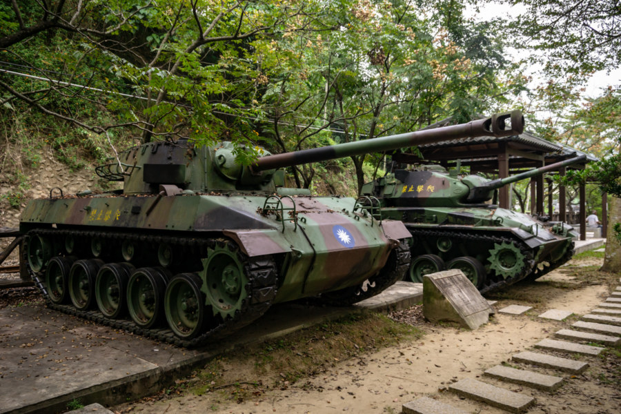
Next to Lóngquán Station (龍泉車站) and the eastern terminus of the Jiji Green Tunnel (集集綠色隧道) one will find a pair of tanks on display. The one on the left is an M18 Hellcat, manufactured for action in World War 2 and discontinued in 1944. Several hundred M18s were sold to the Republic of China in 1952, part of the first round of American military aid given to the KMT after their retreat to Taiwan. The tank on the right is an M24 Chaffee, another WW2-era design, although there is some chance it could be a variant known as the M24A1, which was in service in Taiwan until the late 1990s. The proximity to an enormous military base in the mountains behind the railway station is probably no accident.
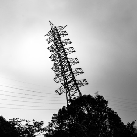
Darkness gathered as I rode through the camphor trees lining County Road 152. Soon I passed into Mingjian and the Nantou 921 Earthquake Leaning Tower Memorial Site (南投九二一地震斜塔紀念地), visible from Provincial Highway 16 if you know where to look. If I’m not mistaken, this transmission tower was knocked to one side by soil liquefaction. There is a small park surrounding the remains of the tower but I didn’t stop long enough for a closer look on this trip. Dusk was settling over the countryside and I still had a lot of driving to do.
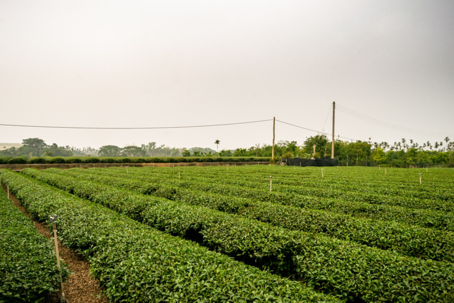
Rather than descend to the rural-industrial sprawl of the Changhua Plain (彰化平原) I opted to head for County Highway 139, which runs the length of Bāguàshān (八卦山), a rocky ridge-line that forms much of the border between Nantou and Changhua. Here, while riding through the hazy tea fields, I experienced a novel physical sensation: a sudden, sharp pain on my exposed leg that might have been a bee sting. I reached down and dislodged a small, black object, initially assuming this to be a piece of glass or grit, but perhaps it was a stinger. Within moments I was overcome by excruciating pain and had to pull over to make a contingency plan. I’ve never been stung but several of my relatives are extremely allergic to bees—and here I was in some unremarkable expanse of countryside, with no help in sight. Several anxious moments followed as I continued north, climbed into the hills, and made it to the nearest convenience store. Thank heaven, 7-Eleven! I applied a bandage to the wound and the magic of endorphins soon dulled the pain. The worst of it passed in about half an hour, but symptoms lingered for another week9.
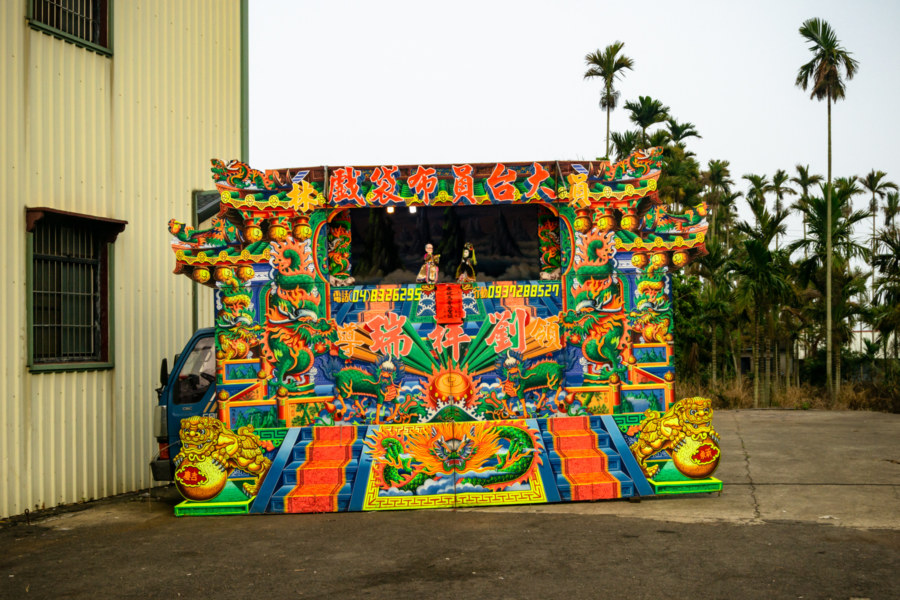
Not far from that convenience store I pulled over to scope out a traditional Taiwanese puppet show (bùdàixì 布袋戲). Such shows are a common sight in the countryside, where individual operators are hired to provide entertainment for the gods (as well as any mortals who happen to be in the vicinity). This particular show was directed at Fúshān Temple (福山宮), a modest shrine to the Lords of the Three Mountains (三山國王) here on the very western edge of Nantou City.
A little further north on the same road I returned to SunnyHills (微熱山丘), easily the best and most famous pineapple cake brand in Taiwan. Founded in 2008 along this desolate highway, it now draws enormous crowds by offering a free pineapple cake and tea to all visitors. Of course I stopped for a sip and a bite—and a box of these delicious treats!
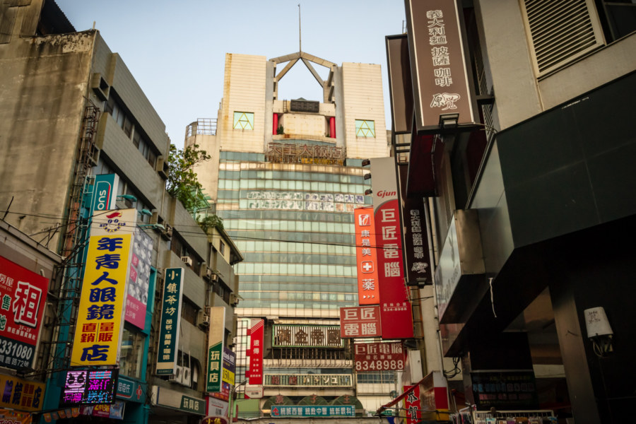
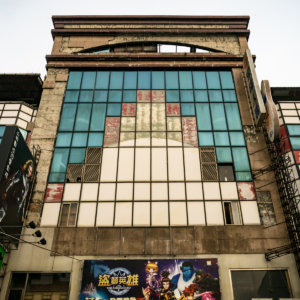
Soon thereafter I descended to the lowlands of Changhua, briefly detouring through Yuanlin to check on the status of the Golden Empire Building (黃金帝國大樓), which also suffered substantial damage in the 921 Earthquake. Somehow this derelict commercial complex—almost completely abandoned apart from some ground floor shops and underground parking—remains the tallest building in town. I’ve made several attempts to gain access to the upper levels but never found a way. Sometimes you get lucky, but not this time.
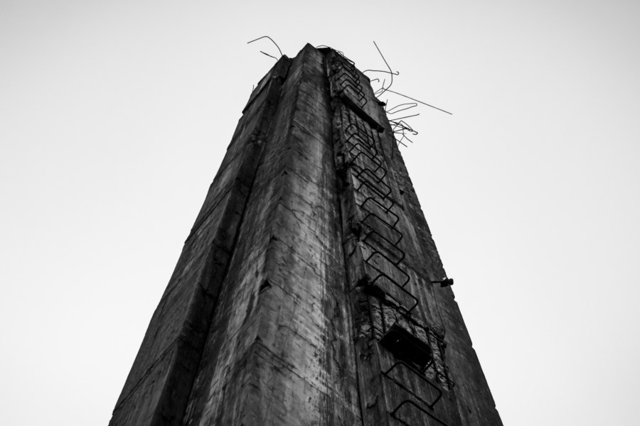
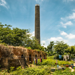
My final photo of the trip was shot while revisiting an abandoned Hoffmann Kiln (八卦窯) along County Highway 137 in Huatan. I suppose this means I completed some sort of brick kiln trifecta, visiting three different kinds of kiln (snake, eye, and Hoffmann) in a single day. Unlike the others, this one does not appear to have affected by the 921 Earthquake. Then again, it is also much more modern than the other two, since it was likely built in the 1960s. Read my full post about this kiln to learn more.
Finally I arrived in Changhua City, where I spent six months at the end of 2014 and beginning of 2015. Since this trip was only another half year after departing I had no trouble finding one of my old haunts for a quick dinner. With the evening traffic rush in full swing I crossed into Taichung and completed my journey at the scooter rental shop across from the Japanese colonial era train station. With this formality concluded I caught a train back to Taipei and was home by midnight.
In hindsight, it is amazing how much I was able to see and experience in a long weekend of road tripping around Nantou. I really didn’t know too much about Taiwan back then, and couldn’t read much Chinese, but still had a good sense of what might be interesting. Much of what I’ve written about in this series was found by accident, often by looking at places on a map and wondering “what might be here?” Raw curiosity will get you far in this country, especially if you’ve got wheels.
Two years later I reprised this trip, setting out from Taichung to return to Puli10, but this time I was in no rush to return the scooter, and I ended up driving as far south as Kaohsiung before making my way back over the course of the summer. If you enjoyed this series be sure to dig into my next big project, a record of my Taiwan Summer Road Trip 2017.
- There are several ways to translate the various Chinese terms used to describe Indigenous people in Taiwan. While writing about another trip through traditional Bunun lands in an earlier post in this series I did some research and attempted to standardize what terms I use in English: people (族), group (群), and community (部落 or 社區). Incidentally, I avoid the use of the term “aboriginal”, which is discouraged by the Council of Indigenous Peoples, as well as “tribe”, which remains a subject of debate in Taiwanese society. The word “tribe” in English carries certain implications that aren’t always positive nor accurate. This post (in Chinese) makes the case that using the word “tribe” in Taiwan is absurd given that you’ll find Indigenous communities on the MRT line in Taipei, for example. As such, I’ve adopted the term “community” to be more neutral and all-inclusive. ↩
- Renlun was formerly known as Rénhé Village (人和村). I am guessing the name was changed to more closely reflect the pronunciation of the village in the local Bunun dialect, which is commonly written Lanlun, Landun, or Lanngdun. Also worth noting: this is almost certainly one of many Bunun groups forcibly resettled in a more accessible locale as part of the Group Relocation Policy (集團移住政策), a direct result of the Truku War of 1914 and, more locally, the Dāndà Incident (丹大事件) of 1917. ↩
- Taiwanese bloggers often comment on this bridge. Check out this video tour of the bridge for more. ↩
- I wasn’t able to find too much information about this former police substation apart from various news reports from 2015. Assuming the reporting was correct, this substation dates back to approximately 1939, and was in use until 2002, when it was abandoned along with the surrounding dormitories. Since search results trail off after 2015 it is probably safe to assume no action has been taken to begin restoration work. ↩
- Checheng has a fascinating history but I’ll save that for another, more in-depth post, as I was only passing through on this particular trip. ↩
- According to this post, the monastery and crematorium occupy land originally intended for the construction of a third power generating station related to the Sun Moon Lake Hydroelectric Project (日月潭水力電氣工事). ↩
- I will admit to enjoying the experience of visiting some of Taiwan’s worst tourist traps, but I seldom write about them in any detail. For some insight into this tacky attraction have a look at this post for more photos. ↩
- Zhǎngchūn Four-Faced Buddha (長春四面佛) is the original shrine in Taiwan, founded in 1983. Interestingly, it was modeled after the Erawan Shrine in Bangkok, which was only constructed in 1956, for pretty much the same reasons (to bring prosperity to a nearby hotel). I write a little more about this phenomena in a post about the Four-Faced Buddha of Yongkang Street. ↩
- More than a week later the wound remained an angry red bullseye the size of my palm, extremely itchy and hot to the touch. ↩
- I have been vague about my reasons for visiting Puli three times over the course of the last several years but it shouldn’t be too hard to puzzle out if you’re really curious! ↩




Write a Comment