Tainan Second Air Force New Village 台南二空眷村

Rende Second Airforce New Village Treehouse 仁德二空眷村

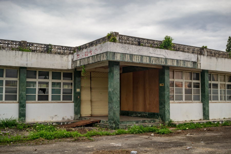
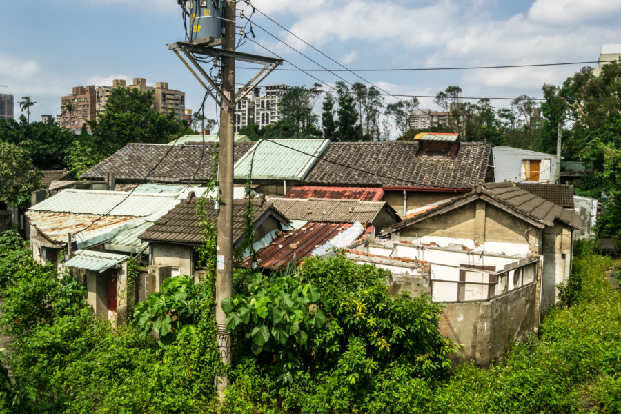
The Second Air Force New Village (二空新村) is a former military dependents’ village in Tainan, Taiwan. It was established east of Tainan Airbase in 1950, primarily for members of the Republic of China Air Force and their families, and it eventually grew to become the sixth most populous of the official military villages in Taiwan. From 1950 into the 1960s several waves of construction and development increased the village to nearly 1,000 households, with a sizable number of unregistered structures scattered around the periphery. As with most other military villages this one was steadily dismantled and demolished over the course of many years in the late 2000s and early 2010s, part of a nationwide urban renewal program that relocated the remaining residents into more modern apartment blocks.

RSEA Marble Factory 榮民大理石工廠

RSEA Marble Factory Office

I chanced upon the ruins of the RSEA Marble Factory (榮民大理石工廠) while riding around the industrial park on the north side of Hualien City sometime in early 2017. It wasn’t immediately obvious what this derelict factory produced so I decided to stop and take a closer look. Although much of this sprawling site had already been cleared, a few half-demolished buildings remained. In one of these I found a pallet full of product samples and several references to marble, answering the first of many questions on my mind. But there’s always more to examine if you’re curious, so let’s dig into the archives and see what can be learned about this abandoned industrial site in Hualien, Taiwan.

Nantou Road Trip 2015: Sun Moon Lake to Taichung

Xinyi Township Mountain Vista

This post is the final entry in a series documenting several days of riding around Nantou in October 2015. On the last morning of this trip I woke in Puli, close to the geographic center of Taiwan. I only had to return the scooter to the rental shop in Taichung sometime after nightfall so I decided to take a more circuitous route and check out many sights along the way. After a quick breakfast I headed south, briefly stopping by the shores of the majestic Sun Moon Lake (日月潭, covered in the previous entry in this series), and ascended a winding mountain access road leading into Xinyi, one of several majority Taiwanese Indigenous districts in this landlocked county.

Postcards From Ershui 二水明信片

Ershui Zheng Ding House 鄭鼎宅

Ershui is a rural township located in the southeastern corner of Changhua, bordering Yunlin and Nantou. Ershui Station 二水車站, constructed in 1935, is the primary point of transfer between the Main Line 縱貫線 of the Taiwan Railway Administration (TRA) and the Jiji Line 集集線, a tourist railway leading into the interior. Ershui, which literally means “two water”, is named after the Bābǎo Canal 八堡圳, an extensive system of artificial waterways still responsible for irrigating much of the Changhua Plain 彰化平原 three centuries after it was devised. During the Japanese colonial era this small town prospered as a center of woodworking while farmers in the countryside cultivated bananas, grapes, guava, and tobacco, among other crops. Nowadays it is mainly known as a sleepy stopover on the way to parts beyond—but a closer look will reveal several points of interest for anyone curious about Taiwanese history, architecture, and vintage style.

Hsinchu Xinyi New Village 新竹信義新村

The General

Pictured here is a bronze bust of generalissimo Chiang Kai-shek in front of the faded emblem of the Kuomintang (KMT) in Xìnyì New Village 信義新村, a military dependents’ village in Hsinchu City. Chiang and the KMT retreated to Taiwan with more than a million Chinese soldiers and their dependents in 1949, bolstering an existing population of seven million Taiwanese. This instantly created a massive housing crisis—all those people needed places to live! The new regime attempted to address this through the development of hundreds of military dependents’ villages, gated enclaves of KMT soldiers and their families, but those were chaotic, desperate, and uncertain times, and many more ended up in informal and often illegal settlements all around Taiwan.

Dadu Plateau Anti-Airborne Fortifications 大肚台地反空降堡

An abandoned fortification on the Dadu Plateau

Dàdù Plateau (大肚台地) is a geographic feature of great strategic importance to the defense of central Taiwan. It overlooks the Qīngshuǐ Coastal Plain (清水平原) and occupies high ground on the far edge of the Taichung Basin (台中盆地), home to the majority of the population of Taichung, the third most populous metropolitan area in the nation. The entire length of the plateau is peppered with military facilities from the massive Ching Chuan Kang Air Base (空軍清泉崗基地) in the north to Chénggōng Ridge (成功嶺) down south. In between one will find a number of abandoned or disused bunkers, gun towers, and blockhouses. This post focuses on seven anti-airborne fortifications located in the central part of the plateau starting with the #7 Anti-Airborne Fort (七號反空降堡), my introduction to this cluster of ruins.

Taichung Aerodrome Gun Tower 臺中飛行場機槍堡

Former Japanese Army Taichung Aerodrome Gun Tower 原日軍臺

Not much remains of the former Taichū Aerodrome 臺中飛行場, a Japanese colonial era airbase originally built in 1911 on the northwestern periphery of central Taichung. The airbase saw a lot of action in World War II and several kamikaze units were stationed there in the final months of the war. After the arrival of the KMT it was used as a hub for aviation research and development before entering into civilian use in the 1970s as Shuǐnǎn Airport 水湳機場. In 2004 operations were transferred to the nearby Taichung Airport 台中航空站 and, over the following decade, the former Japanese airbase was completely demolished as part of an ongoing city-wide urban renewal plan. The only building spared was a lone gun tower built in 1940, formally designated a historic site in 2006, and officially known as the Former Japanese Army Taichung Aerodrome Gun Tower 原日軍臺中飛行場機槍堡.

Traces of an Army Maintenance Depot

A trace of martial history in Xinyi District

Xinyi is now one of the most expensive and upscale parts of Taiwan but it hasn’t always been that way. Decades ago it was an undesirable area on the edge of the city with a significant military-industrial presence, traces of which still remain if you know where to look. The open expanse of parks and parking lots around the intersection of Xìn’ān Street (信安街) and Wúxìng Street (吳興街) immediately to the west of Taipei Medical University (臺北醫學大學) is one such trace.

Jiahe New Village 嘉禾新村

In the heart of Jiahe New Village 嘉禾新村

Jiahe New Village (嘉禾新村) is one of more than 800 military dependents’ villages (Chinese: juàncūn 眷村) built in Taiwan in the late 1940s and 1950s to provide provisional housing for KMT soldiers and their families fleeing from the Chinese Civil War. Approximately two million people crossed the Taiwan Strait from China from 1945 to 1949, bolstering an existing population of approximately seven million. More than 600,000 of these Chinese immigrants ended up in military villages like this one in Zhongzheng, Taipei, which was forcibly abandoned only a couple of years ago as part of a wave of urban renewal projects sweeping the nation.

Jiahe Railway Tunnel 嘉和遮體

A tunnel on the coastal plains of Pingtung

Here is yet another roadside curiosity in the deep south of Taiwan: a false tunnel on the coastal plains of Fangshan, Pingtung. It doesn’t cut through any mountainside nor is it built to withstand landslides. It’s just an 1,180 meter tunnel that trains pass through for no discernible reason. I first read about this on Michael Turton’s blog and later saw it on my first round-the-island bicycle tour. More recently I took a spin around the southern loop once more, and spent a little extra time examining this concrete oddity in an attempt to divine its purpose.