Postcards From Linnei 林內明信片

Tobacco Barn in Rural Linnei

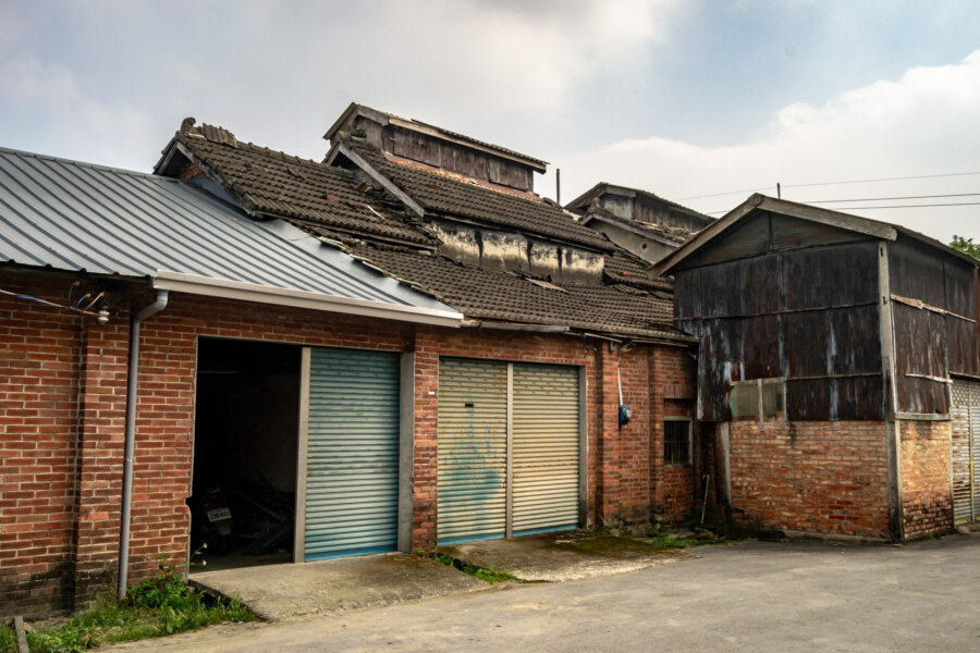
Linnei is a small rural township located on the south side of the Zhuoshui River in northeastern Yunlin, Taiwan. Despite its strategic position on the Western Trunk Line this township remains mostly pastoral and undeveloped, with little industrial activity compared to neighboring Douliu, the administrative seat of the county. Population in the township peaked at nearly 23,000 in the 1970s and has been declining ever since, recently falling below 18,000 as rural flight continues apace. Nowadays the local economy mostly revolves around agricultural products such as rice, bamboo, and tea, but Linnei was once a major center of tobacco cultivation, traces of which can be found scattered across the countryside.

Postcards From Yuanlin 員林明信片

The Golden Empire Building

Yuanlin is a modest settlement of approximately 125,000 residents located on the Changhua Plain (彰化平原) in eastern Changhua, Taiwan. It was formerly the most populous urban township in the nation, but Yuanlin was upgraded to a county-controlled city in 2015, second only to the administrative capital, Changhua City. Considerable work has been done in recent years to improve the urban environment of Yuanlin, and it feels like one of the few places between Taichung and Tainan that isn’t falling into disrepair and emptying out. That being said, urban decay remains widespread in Yuanlin, and there are many interesting ruins worth exploring before they disappear. For students of city planning and development this compact city also has quite a lot to offer—and in this post I aim to introduce some of its more intriguing features, mainly drawing upon photographs from 2013 to 2015, when I was spending significant amounts of time in the area.

Postcards From Ershui 二水明信片

Ershui Zheng Ding House 鄭鼎宅

Ershui is a rural township located in the southeastern corner of Changhua, bordering Yunlin and Nantou. Ershui Station 二水車站, constructed in 1935, is the primary point of transfer between the Main Line 縱貫線 of the Taiwan Railway Administration (TRA) and the Jiji Line 集集線, a tourist railway leading into the interior. Ershui, which literally means “two water”, is named after the Bābǎo Canal 八堡圳, an extensive system of artificial waterways still responsible for irrigating much of the Changhua Plain 彰化平原 three centuries after it was devised. During the Japanese colonial era this small town prospered as a center of woodworking while farmers in the countryside cultivated bananas, grapes, guava, and tobacco, among other crops. Nowadays it is mainly known as a sleepy stopover on the way to parts beyond—but a closer look will reveal several points of interest for anyone curious about Taiwanese history, architecture, and vintage style.

Xiluo Bridge 西螺大橋

The North End of Xiluo Bridge

Xiluo Bridge (西螺大橋) spans the mighty Zhuóshuǐ River (濁水溪), the unofficial boundary between north and south Taiwan, connecting the counties of Changhua and Yunlin. Construction began in 1937 under Japanese colonial rule but came to a halt after the attack on Pearl Harbor as the allotted steel was needed for the war effort. In 1952 the bridge was completed under the incoming Chinese Nationalist government with American steel and financial aid. At 1,939 meters in length it was one of the longest bridges in the world when it was finished—second only to the Golden Gate Bridge at that time—and became such a source of national pride that it appeared on Taiwanese bank notes (specifically 第一套橫式新臺幣) and stamps in the 1960s. Originally it was equipped with sugar railway tracks but these have been removed and nowadays only light road traffic is permitted to cross the bridge.

Brutalist Parkade

Stripped down to the core in Caotun

Just a parking garage.

Cǎoxiédūn Public Parkade 草鞋墩公有立體停車場 is an intimidating structure looming over one of the main commercial shopping streets in Caotun, Taiwan. I was there in search of an abandoned theater but was immediately impressed with the strikingly brutalist design of this multi-storey car park. It is merely a place to park so there’s little more to say, though it would seem that it was recently derelict. Probably the only other tidbit of information worth conveying is that “Caoxiedun” refers to the original name of the town. You can be sure the first settlers never imagined this monument to honest architecture standing in their newly sown fields.…

Southern Taiwan Ride 2015: Dawu to Taitung City

Looking south from Taimali along the coastal highway in Taitung

My last big day of riding around southern Taiwan in June 2015 began in Dawu, Taitung, with only about 55 kilometers to go before arriving in Taitung City. I had been out in the sun far too much the previous day and was feeling rather sluggish and a bit sick so I didn’t end up taking any side trips into the mountains as I made my way north. Even so, the scenery was fantastic, and while I won’t have as much to write about this particular day of my trip, I have plenty of beautiful photographs to share.

A Quick Trip to Jiufen and Keelung

Shuqi Road, the famous stairway in Jiufen

Last weekend I enjoyed a couple of days outside of Taipei in the northeastern part of Taiwan. I went there with friends, ostensibly to show them around Jīnguāshí 金瓜石 and Jiǔfèn 九份, a famous mining town and major tourist attraction in the mountains of Ruifang, and ended up staying in Keelung for the night on a whim. Having recently purchased a new phone I bombarded Instagram with numerous pictures and plenty of commentary as the trip progressed. This quick and dirty post is a collection of some of my better smartphone snapshots as well as an experiment in blogging with broader brushstrokes. Perhaps you will get a sense of how I travel: spontaneously, intuitively, and with a keen eye for details.

Asia Cement Aerial Tramway 亞泥空中纜車

A tramway tower in Hsinchu County

Yesterday I went out with a friend to explore several abandoned and neglected sites in Hsinchu, Taiwan. Our first stop was one of many mothballed cable car 空中纜車 towers in Guanxi connecting a stone quarry near Yùshān Village 玉山里 (formerly known as Chìkēshān 赤柯山) with a cement plant next to Jiǔzàntóu Station 九讚頭車站 in Hengshan. There seems to be no general agreement about the formal name for the system so I’m picking one of many options and dubbing this the Asia Cement Aerial Tramway 亞泥空中纜車 for the sake of simplicity.

An Iconic Pedestrian Bridge in Keelung

An iconic pedestrian overpass in Keelung

It’s grim up north. But that same darkness keeps me coming back to Keelung, Taiwan’s most important northern port, to explore its dense, multi-layered urban core. Pictured here is a long pedestrian overpass that snakes around and over the railway station for about 200 meters. It is visible on Google’s satellite view, running the length of Keelung’s Zhongshan Bridge 基隆中山陸橋 (also known as the Keelung Train Station Bridge 基隆火車站陸橋). After posting this photo on Flickr a visitor pointed out that this is the same pedestrian bridge featured in Millennium Mambo 千禧曼波 (watch the introduction on YouTube and you’ll see it). I was going to post it anyway but this adds another layer of meaning to this obscure work of urban psychogeography.

Changren Waste Flues 長仁廢煙道

Remnants of a lost kingdom

The waste flues of Ruifang are an extraordinary sight. The ruins of these massive, crumbling conduits run for miles up the mountainside from the Shuinandong Smelter 水湳洞精鍊廠 and the rest of the abandoned mining complex below. Originally built during the KMT authoritarian era to transport noxious fumes and waste gases away from the refinery—and nearby settlements like Jīnguāshí 金瓜石—these flues are reputedly the longest in the world.