My fifth day of riding around southern Taiwan in June 2015 delivered me to the most remote parts of the island’s 1,139 kilometer-long coastline. On the previous day I rode from Fangliao, on the southwestern coast, around Hengchun and into the foothills of the Central Mountain Range 中央山脈 to reach Manzhou, one of the last places to find lodging before forging on to Taitung. I had already taken this route while riding all around Taiwan in 2013 so I was familiar with the territory, but that first tour was so rushed that I hadn’t been able to enjoy the scenery. (Actually, I had been outrunning a typhoon the last time I was here—but that’s a story not yet told on this blog.) This time around my intent was to take it slow and explore more of this obscure part of coastal Taiwan.
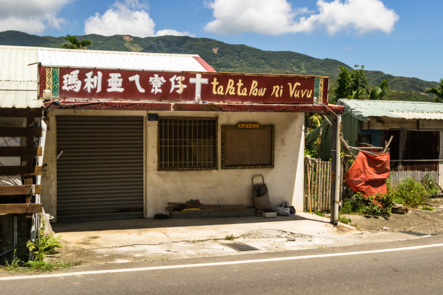
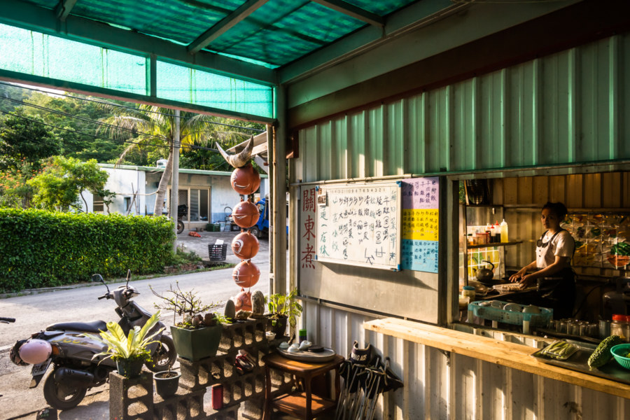
Part of my reason for overnighting in Manzhou was to maximize how much time I had on the road but I overslept and didn’t really get going until 9 or 10. Before departure I spent about an hour riding around the small town, scoping out local architecture and wondering what it was like to live in such a place. I also stopped for a quick breakfast at a quaint old shop on the main road curving through town to power up for the day. I knew that rest stops would be few and far between once I left town.
The southern tip of Taiwan is the traditional territory of the Páiwān 排灣族, one of the major groups of Taiwanese Indigenous people. In Qing dynasty times most Paiwan lived beyond the Tǔniú Boundary Line 土牛界線 that divided lands settled by Chinese immigrants from those of the highland Indigenous people (Chinese: Gāoshānzú 高山族). Manzhou in the 19th century, like much of the rest of the Hengchun Peninsula 恆春半島, was the domain of a confederation of eighteen communities known as the Seqalu 斯卡羅. One of these communities came into conflict with the Americans in an event known as the Rover Incident in 1867. After an ill-advised and unsuccessful punitive mission was mounted that same year an American diplomat, Charles Le Gendre, ventured into Manzhou to meet with Tauketok 卓杞篤, chief of the Seqalu, at Sabaree (now Yǒngjìng Village 永靖村, which I had unknowingly cycled through the previous evening). There a treaty was signed to ensure the safe passage of shipwrecked sailors. Back in those days Manzhou was known by its Indigenous name, Manutsuru, and a Taiwanese Hokkein transliteration, Báng-sut 蚊蟀 (sometimes simply Bangsut). It was never far from my mind that I would spend the entire day in Indigenous lands.
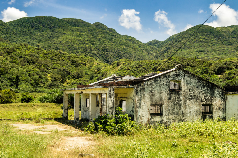
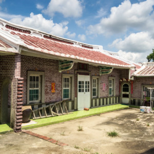
The loose alliances of the Seqalu fell apart near the end of the century and the Japanese, after conquering Taiwan in the aftermath of the First Sino-Japanese War, soon set out to integrate the remaining Indigenous territory into its fledgling colony. I’m not entirely sure what happened in the decades after the Japanese arrived but Manutsuru was renamed Manshū 滿洲 in 1920. Evidently this marked the arrival of modernity to the idyllic countryside, as several famous old buildings in town were built not long after the renaming.
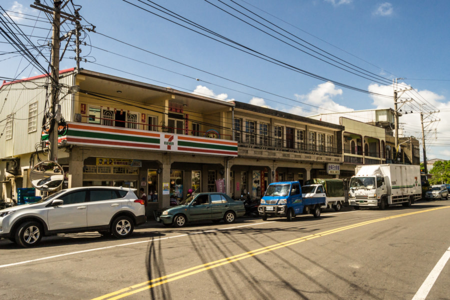
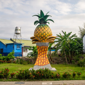
After a quick tour of Manzhou I stopped in at the 7-Eleven to pick up supplies for the day’s journey, mostly water and a few sports drinks. I knew from my previous tour through the area that it was the last modern convenience store before arriving in Taitung. This is remarkable given how ubiquitous convenience stores are in Taiwan. While there are other places to procure water (particularly police stations in the small villages along the way) the lack of air-conditioned rest stops would prove to be a major challenge for me on such a sweltering hot day in early June.
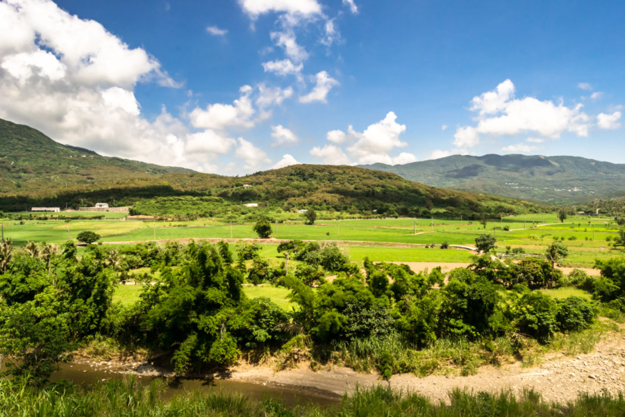
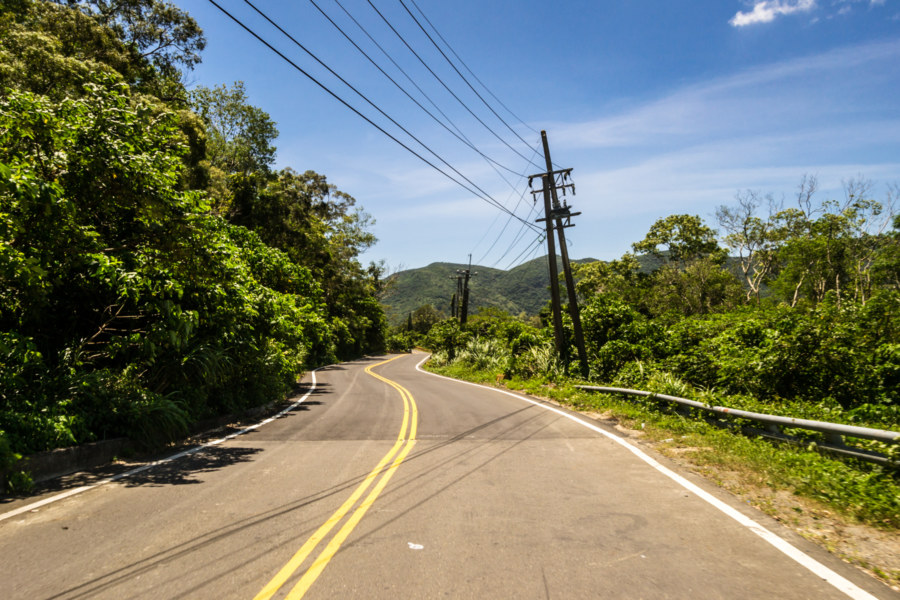
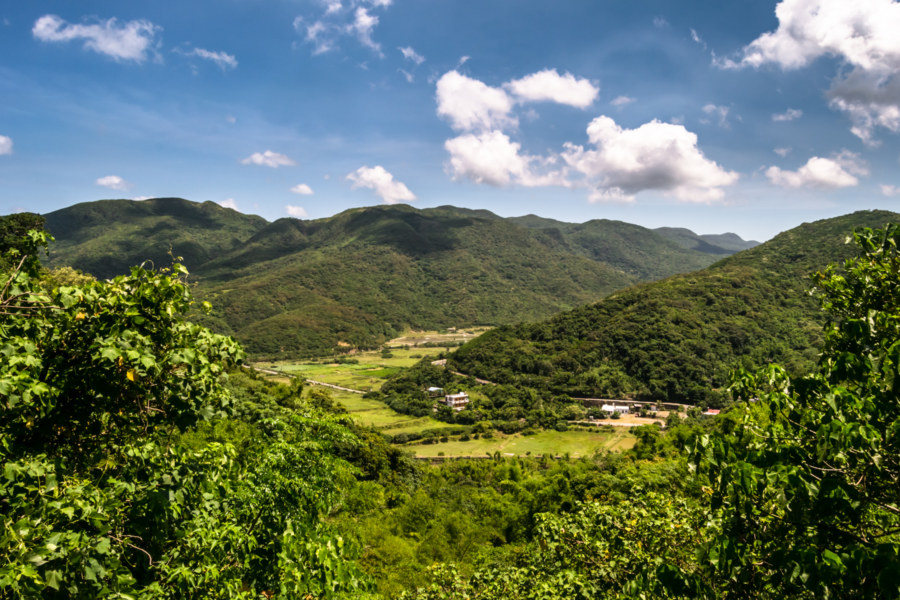
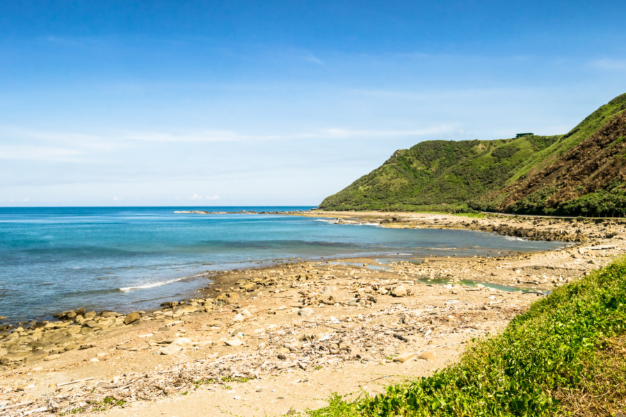
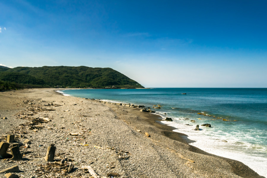
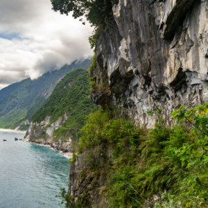
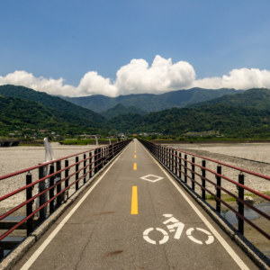
I set out along Highway 200, which winds its way up the valley to a saddle near the entrance to Gāoshì Village 高士村. The grade is slight but the relentless tropical sun makes it feel worse than it is, particularly after days of riding on the flatlands of the southwestern plains. After a while I crested the ridge and began the descent toward Jiǔpéng 九棚, a small farming community along the eponymous Jiupeng Creek 九棚溪. Usually one would continue along the highway—but I decided to take a brief detour of about 12 kilometers (round trip), hooking south along Nánrén Road 南仁路 to check out the tiny settlement of Nánrén Village 南仁村. Beyond lies only the rugged coastal trail of Chūfēngbí 出風鼻 (literally “Windy Nose”; often romanized as Qufengbi), nicely introduced by Kirk Beiser here and here.
Naturally I was very interested in seeing the wreck of the Aviva Cairo, a container ship lost in Tropical Storm Fung-wong as it was being towed from Manila to Thailand in September 2014. After drifting at sea the ghost ship ran aground on this remote stretch of coastline where it will remain forevermore. Unfortunately it would have taken several hours of hiking to get there and back again—and in the blistering noonday sun I was counting every minute of exposure. I would say “maybe another time” but I hear the wreck has been mostly dismantled already.
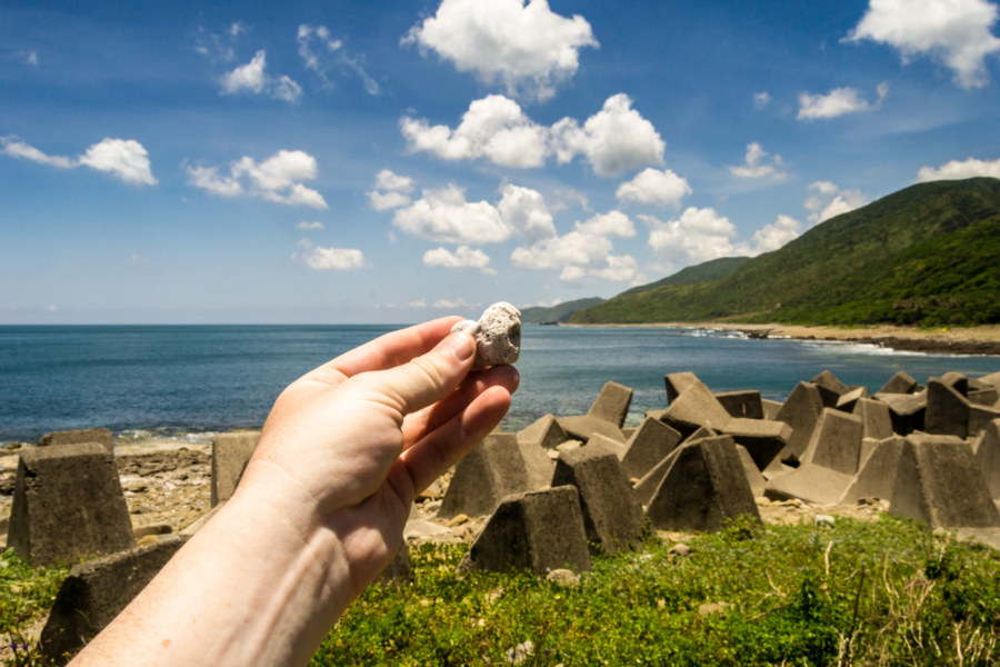
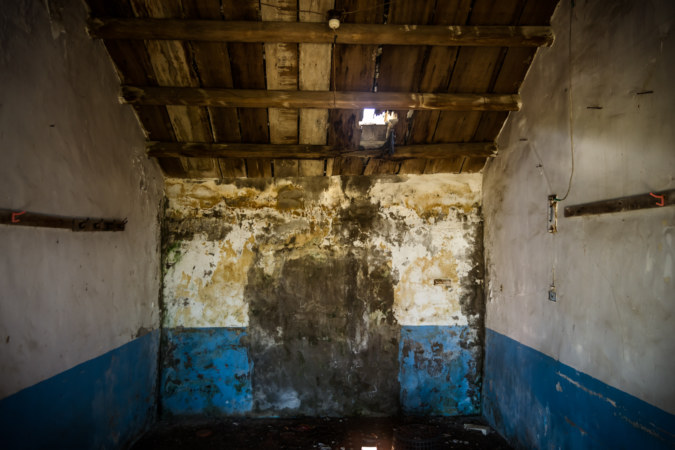
Nanren Village is little more than maybe a dozen homes, several of them abandoned, next to a police station and tiny concrete-walled harbour that hardly looks used at all. It is literally the end of the road—the very last point accessible by motor vehicle along this wild stretch of coast. I grew up browsing atlases and wondering about what might be found in obscure, faraway places and extreme locations. Google brought many such places to our computer screens with Street View but there’s nothing quite like being there in reality. A palpable sense of desolation and estrangement from the modern world pervaded the village. I picked up a piece of coral I found at the very end of the road and captured it in its natural environment, something as yet unseen by the eyes of the overworld, before going to check out some nearby ruins.
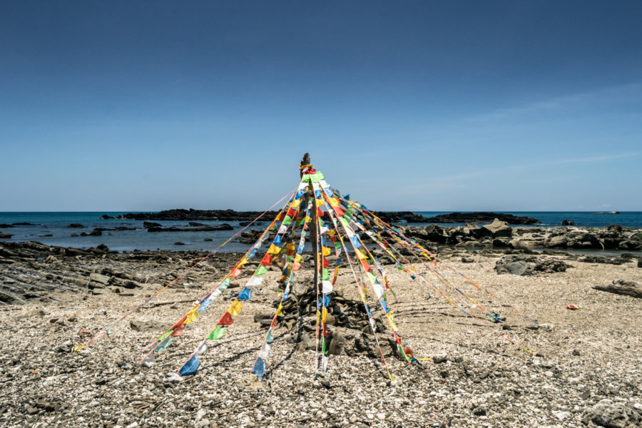
On return trip to the highway I stopped to take a closer look at a rocky headland by the name of Yùbí 鬱鼻 (“Melancholic Nose”), which forms the southern extent of Bāyáowān 八瑤灣, or Padriyiur Bay, where 54 Ryūkyūan sailors were massacred in 1871 in an event now known in English as the Mudan Incident (see my previous entry in this series for a little more about that). Here I found prayer flags, or jīngfān 經幡, fluttering in the assertive winds coming off the vast Pacific Ocean. This is somewhat unusual in that prayer flags are more of a Tibetan custom than a Taiwanese one—but they certainly add something to the already gorgeous landscape. Is this an informal memorial to all those who perished as a result of what happened here more than a century ago? I have no answers.

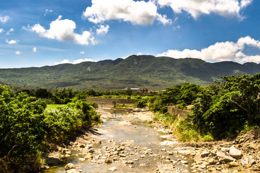
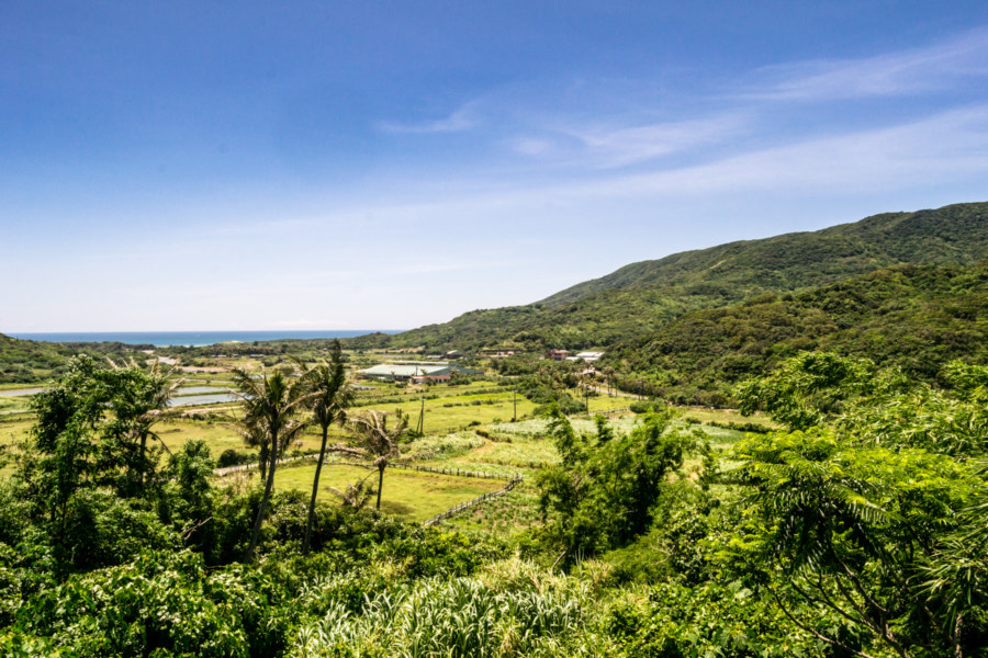
In Jiupeng I stopped at a small shop, really not much more than a betel nut stand, to stock up on water before hitting the highway again. Along with the proprietress there were several old men sitting around drinking beer and chewing betel nut in the shade. Not much else to do out here, is there? We had a friendly chat with what words we shared, gesturing to fill in the gaps, and then I went on my way. The highway curves back into the hills a short distance before sweeping down into Gǎngzǎi 港仔, a small settlement at the north end of the bay.
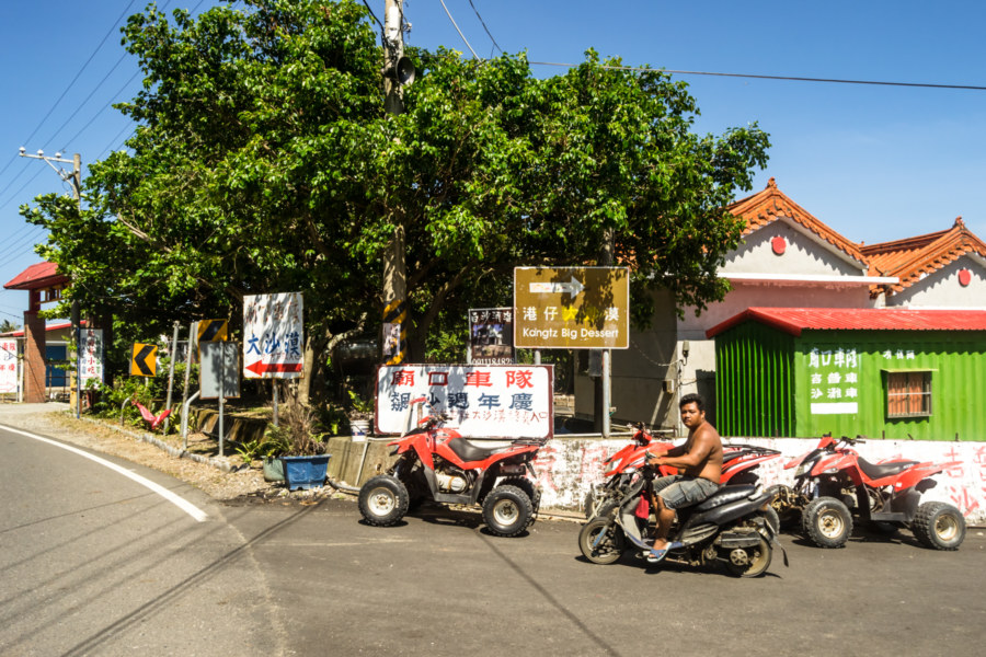
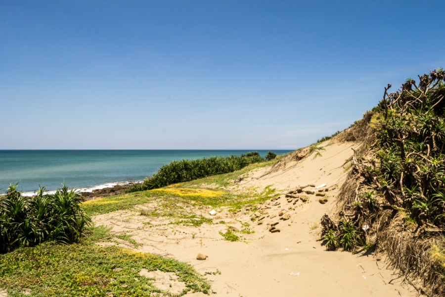
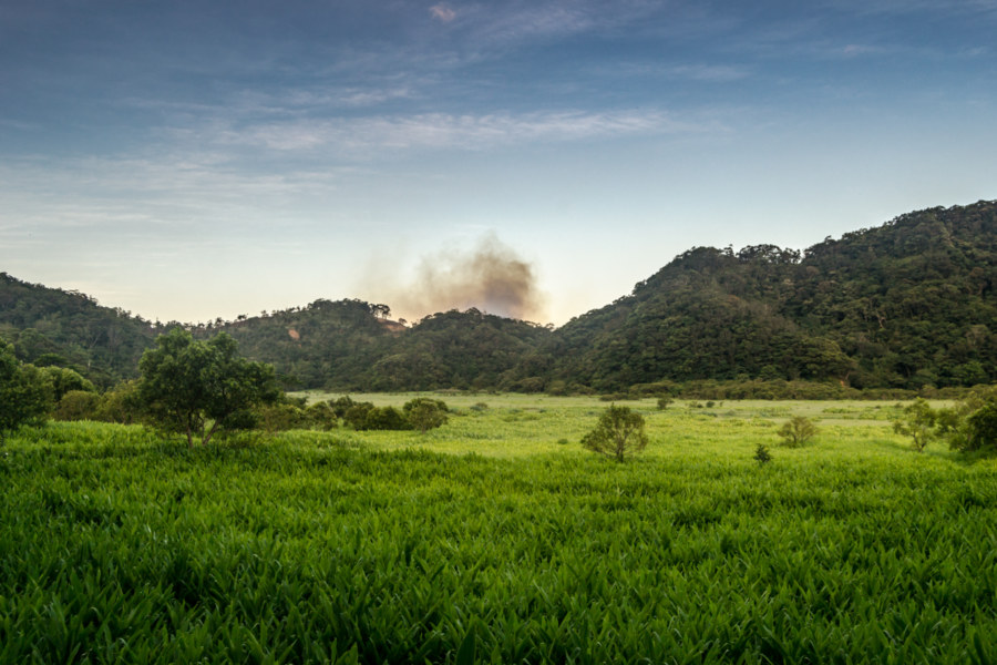
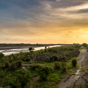
Gangzai is the main point of entry to the extensive coastal sand dunes that run along Bayao Bay. Known as the Great Desert (Dà Shāmò 大沙漠) of either Jiupeng or Gangzai, it is the largest dune field in Taiwan. That isn’t saying much, however—the dune field is only about 2 kilometers long and not particularly wide. These dunes are formed by windblown sediment deposited by the sluggish Gangzai Creek. I have read in places that these sand dunes formed as a result of the foehn wind or fénfēng 焚風 (literally “burning wind”) that afflicts much of eastern Taiwan but this isn’t correct; such winds would be far more likely to blow the sand out to sea. I am not entirely clear on why such extensive dunes formed here and not elsewhere along the eastern coast but my guess is that local topography ideally channels trade winds that flow unimpeded across the ocean.
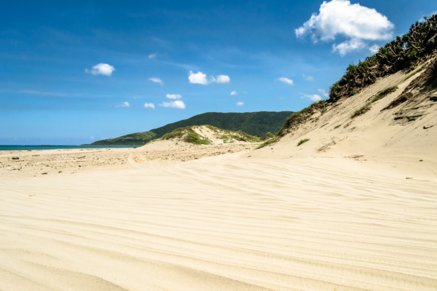
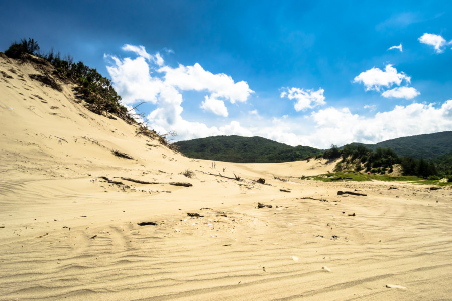
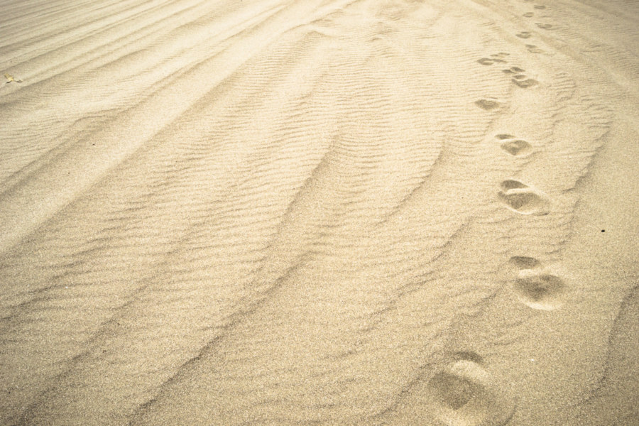
Jiupeng Desert is primarily used as a playground for dune buggies and ATVs. This strikes me as a rather gaudy use of a rare and beautiful landscape but I’m not here to judge. I cycled over to the entrance, dropped the kickstand, and forded the stream to take a closer look at the dune fields on foot. It was hot out there under the blistering sun—and by that point I had already spent hours biking around without respite. I was momentarily amused at the prospect of collapsing into a heap in this tiny desert but it was actually getting somewhat serious. I retreated in search of someplace to cool down for a while and ended up at the local police station beneath a fan for about fifteen minutes. After filling up on water I rounded the headland and forged ahead into Mudan (Sinvaudjan in Paiwan and Bó͘-tan or Botan in Hokkien), a place of great significance in Taiwanese history.
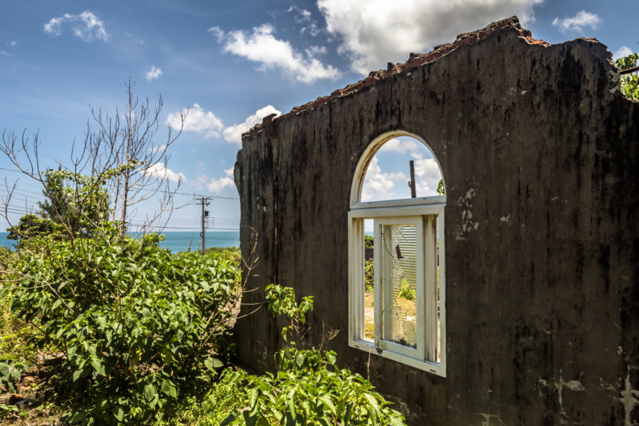
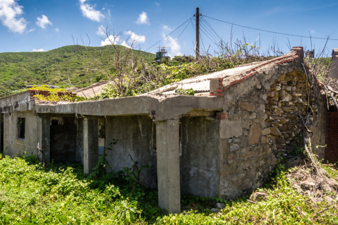
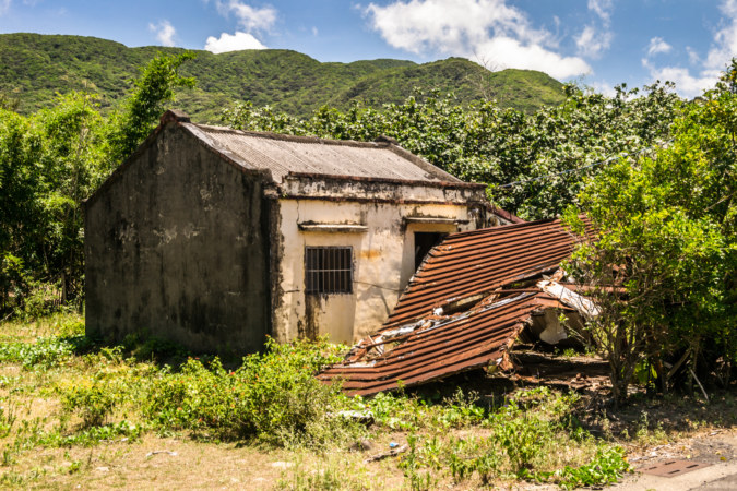
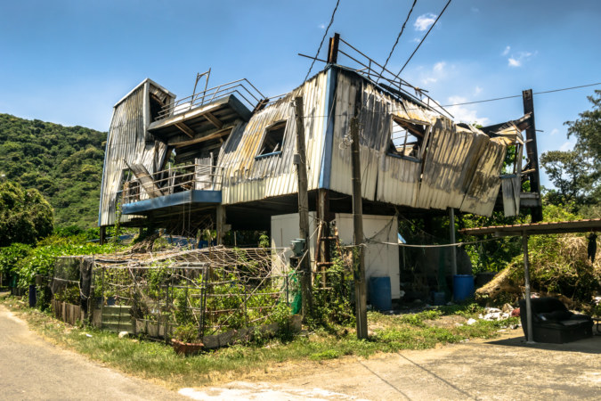
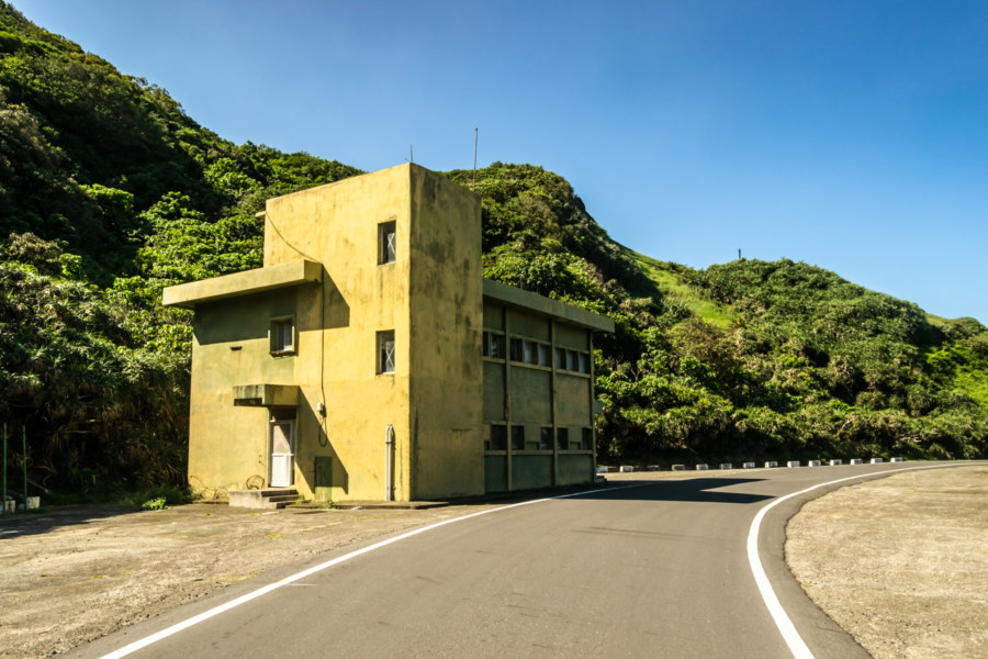
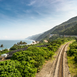
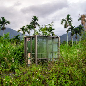
An isolated fragment of Provincial Highway 26 known as the East Sea Road 東海路舊址 runs north from Gangzai to Xuhai. Until recently this stretch of coastline was inaccessible to the general public due to its proximity to the formerly top secret CSIST missile testing base in the hills above. Known as Jiupeng Base 中科院九鵬基地, it still holds live-fire drills and appears to be a target for Chinese espionage, though I knew none of this when I passed through on two wheels. A side effect of decades of military operations is the total absence of human habitation along this stretch of coastline—and the presence of numerous abandoned but rather well-secured buildings.
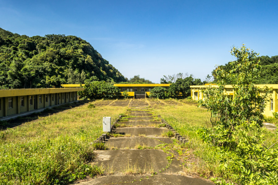
Having previously cycled along East Sea Road in the midst of an oncoming typhoon I was hoping to stop and take a closer look at some of the abandoned military facilities this time around. Unfortunately I was nearing exhaustion as I crept along this lonely, wistful coastline. Despite my best effort to remain hydrated and take occasional breaks in the shade I could feel the sunstroke creeping in. I had only put 35 kilometers behind me and still had another 40 to go before reaching Dawu—including the biggest ascent of the day. Internal calculations of remaining energy reserves left me feeling that I had better press on rather than stop to explore.
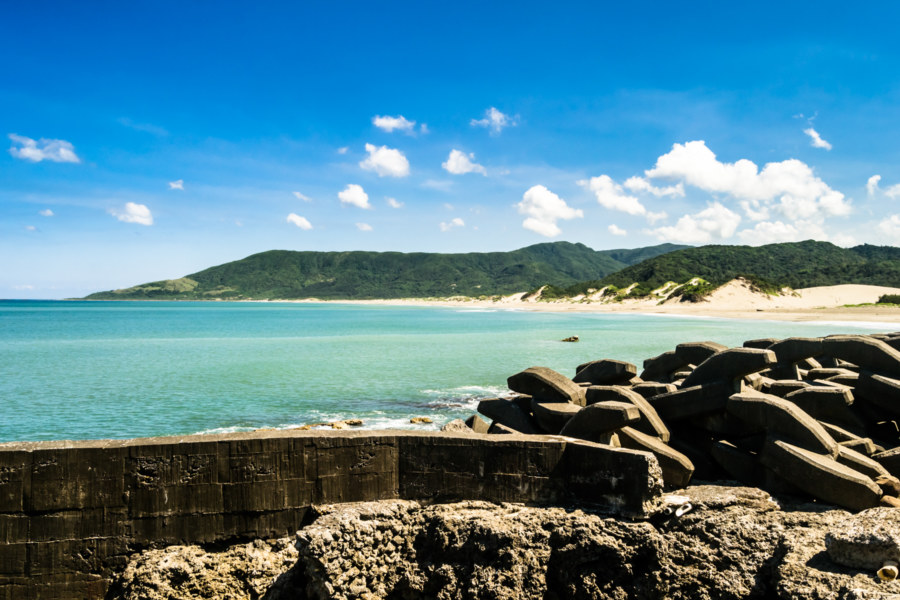
Highway 26 ends at Mǔdān Bay 牡丹灣 and the village of Xùhǎi 旭海 (traditionally Smacharn, Marcharn, or Macaran), an ethnically mixed seaside settlement with a complex history. Whereas most of the Indigenous villages in the area are Paiwan this particular village was founded by Southern Ami 恆春阿美 escaping persecution on the other side of the peninsula. They were joined by several Han and Hakka Chinese settlers and have since integrated some military veterans into their community. I turned left onto County Road 199甲 at the crossroads and began a slow and steady climb into the mountains as daylight began to fade. Mudan, I should mention, is a Mandarin transliteration of the Taiwanese Hokkien pronunciation of the Paiwan Indigenous place name Sinvaujan. Mudan was never controlled by the Qing and wasn’t formally integrated into Japanese Taiwan; it remained Fāndi 蕃地, literally “savage land”, until the KMT took over after the war.
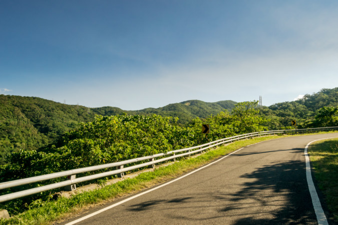

Climbing into the highlands was hard work after a day in the sun. I knew from last time how strenuous it would be—but it hadn’t been as brutally hot on that first tour. I went slow, stopping to rest as often as I felt the need, and to appreciate the abundant natural beauty of my surroundings. There were many Formosa rock macaques around as I made my way up the mountain road, laughing maniacally at my ordeal from the safety of the trees. I bore the brunt of their mockery with a smile.
At one point two young dudes on cruddy mountain bikes zipped by me as I stood by the roadside in a daze, sweat dripping off my skin. I was surprised at their appearance, for they had no special equipment and seemed completely unprepared for the climb. Local kids, perhaps? I was incredulous at that thought—this wasn’t the sort of road you’d casually ride after school. They disappeared around a bend without acknowledging my presence (not that they should, but it’s common for touring cyclists to wave). I caught up to them a while later without saying anything—but they got the best of me when I reached the top of the hill and stopped for a snack at a small roadside eatery at the meeting point of two branches of County Road 199.
Somewhat recharged after my first meal since breakfast I continued on into Dōngyuán Village 東源村 (originally Maliba), where I had stayed on the night of the Mid-Autumn Festival in 2013. That was an unusually eventful night, one that I really should get around to writing about. Suffice to say, most of the grown-ups in town partied so hard that they were passed out when I arrived and I spent much of my night hanging out with the children of the village. As I approached the general store where it all went down I was curious to see if anyone would remember me. Inside I found a bunch of elderly ladies playing cards, none of whom seemed familiar, and the same shopkeep who the children had roused to procure the key to a rental villa. No flash of recognition crossed her face so I paid for a couple bottles of water and got going.
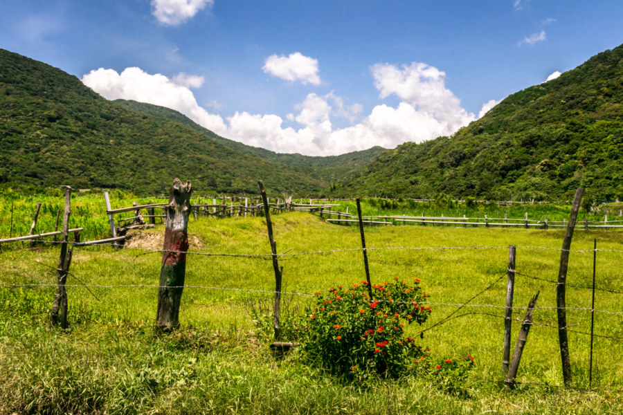
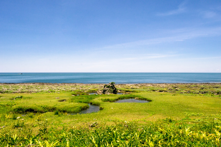
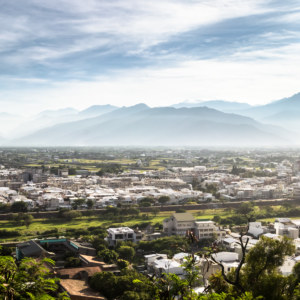
Dongyuan is a curiously serene place. Situated in a small valley at about 300 meters elevation this town of approximately 500 Paiwan was founded sometime during the Japanese colonial era. From what I’ve read the villagers originally lived somewhere in Fangshan but were relocated here for reasons that are obscure to me. The grassy marshland setting is apparently as artificial as the founding of the village: the creek that runs through the valley has been dammed somewhere to support the cultivation of various aquatic plants with some commercial value. The result is a scenic area known as the Dongyuan Wetlands.

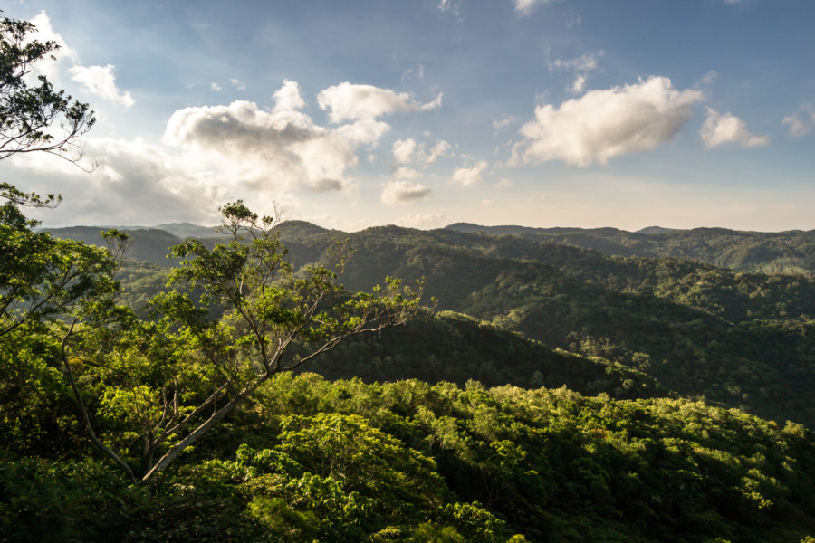
Daylight was fading fast as I departed Dongyuan by way of County Road 199. Without the sun beating down on me I made good progress but there wasn’t much to see and even less to take pictures of. The 199 arcs through the mountains on the margins of Shizi for about 10 kilometers before ending at Shòukǎ Station 壽卡鐵馬驛站, an important rest stop on the South-Link Highway 南迴公路, the segment of Provincial Highway 9 that spans Hengchun Peninsula. With an elevation of 455 meters above sea level this formerly abandoned police station is the highest point on the highway and the gateway to Taitung. It is also, unless I am mistaken, the highest point that absolutely must be crossed to complete an entire bicycle tour around Taiwan.
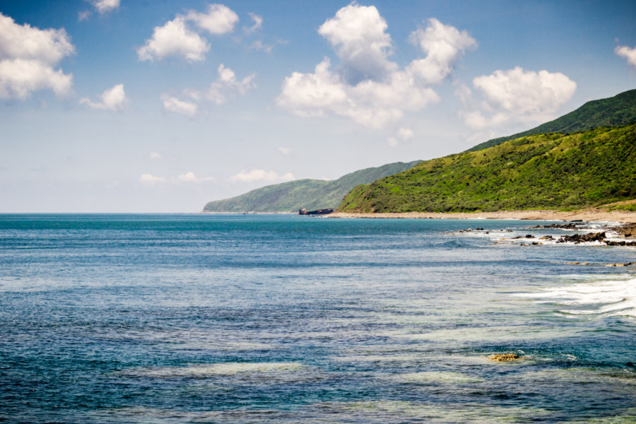
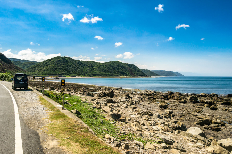
From Shouka Station to the sleepy coastal hamlet of Daren it is an almost continuous descent for approximately 12 kilometers. Ordinarily this would be an exhilarating way to conclude hours of climbing but it was somewhat stressful after dark. The South-Link Highway is one of only three roads connecting western and eastern Taiwan—the other two being the Central Cross-Island Highway 中部橫貫公路 and the Suhua Highway 蘇花公路, both more than 200 kilometers to the north. Think about that for a moment: all road vehicles travelling overland from southern to eastern Taiwan must take this road. It is wide and fairly well-maintained but I had to pay close attention to the many transport trucks and other large vehicles as I slipped down the gravity well to the rest stop at Ānshuò 安朔 (apparently a corruption of the original name Ālǎngyī 阿朗壹, which is Aljungic in Paiwan and sometimes Allingid in 19th century accounts).
I savoured the air-conditioning at the first 7-Eleven I had seen since leaving Manzhou that morning and then continued on to the coastal highway, still unsure of where I would end up. My plan was to get to Taitung and bike around until I found a suitable place to stay before finishing the ride the following day. I still had a little energy left so I decided to press on to at least Dawu.
Not long after reaching the coastal highway I passed two cyclists who were obviously engaged in repairs by the roadside. With a start I realized they were the same two kids who had passed me back in Mudan more than an hour before. I looped around and stopped to offer assistance, recalling that they hadn’t looked as prepared as I was. Turns out it was nothing serious—just a tangled chain—but I learned something about their origins. They were university students from Hong Kong riding around Taiwan on the cheap—hence no helmets, panniers, or even decent bicycles to ride. From the sounds of it they were getting by on instant noodles and surfing couches or sleeping in temples as they went. We ended up riding most of the way to Dawu together but I could tell one of them didn’t care for me much. They disappeared shortly after we reached town as I was keen to have a hot meal and they seemed content with marginally cheaper convenience store fare.
By that point I was completely exhausted so I didn’t put much effort into looking for a place to stay. I booked a room at the first purportedly cyclist-friendly hotel I found on the main drag and went to snap up dinner before all the restaurants closed. From the looks of it there wasn’t much else to do around town after dark so I soon retired to my room—along with a motley collection of cockroaches scampering about. I chased a few out into the hallway, a futile gesture if there ever were one, and after a long cold shower collapsed into bed, enjoying a dreamless rest before the final push to Taitung City.
Great landscape! Nice Richters! Thank you for sharing. I would love to do this trip myself.