Wūshāndǐng Mud Volcano (烏山頂泥火山) is a modest geological curiosity in the hilly badlands of Yanchao, Kaohsiung. It is the largest and most impressive mud volcano field in Taiwan. I first heard about the place through this excellent article by Richard Saunders, who also published an illuminating article about mud volcanoes in the China Post.
Explorations of the natural world at the interface between creation and artifice.
Adjacent Terms
Nantou’s Misty Lotus Forest 忘憂森林
Collected here are a series of dreamlike photos from a road trip into the misty mountains of Lugu in Nantou, central Taiwan. I undertook this trip with a friend in July 2014. Our goal was the Lotus Forest 忘憂森林 (pinyin: Wàngyōu Sēnlín), also known as the Misty Forest 迷霧森林, a high mountain bog formed in the aftermath of the catastrophic 921 earthquake when a landslide altered drainage patterns, forming a small lake and drowning part of the existing forest. At an elevation somewhere close to 2,000 meters, the Lotus Forest is often shrouded in thick fog, imbuing it with an eerie mystique that attracts Taiwanese people from all over the island.
Yinhedong 銀河洞
Yínhédòng 銀河洞 (literally “Milky Way Cave”) is an extraordinary cliffside temple next to a gorgeous waterfall in the mountains just outside of Taipei. Originally founded in 1914 and extensively renovated in 1958, the temple recently celebrated its centennial, as proclaimed by the red banner draped out front during my first visit in February 2014. In a story that sounds entirely apocryphal, the cave was reputedly a hideout for Chén Qiūjú 陳秋菊, a Shenkeng resident who famously led a rebellion in the earliest years of the Japanese colonial era.
Tanjung Simpang Mengayau 3
Here is the final gallery featuring photos from Tanjung Simpang Mengayau, the northernmost tip of Borneo, in Kudat. All of these shots were captured on Pantai Avoi with the exception of the last photo which was shot on the road heading back to Pantai Kalampunian.
Tanjung Simpang Mengayau 2
This is the second of three galleries featuring photographs captured near Tanjung Simpang Mengayau, the northernmost tip of Borneo, in the state of Sabah, Malaysia. All of these were shot on Pantai Kalampunian, the beach on the western side of the tip along the South China Sea.
Tanjung Simpang Mengayau 1
The first of three galleries showing off the natural beauty of Tanjung Simpang Mengayau in Kudat, the northernmost tip of Borneo, in the state of Sabah, Malaysia.
Riding the Seawall in January
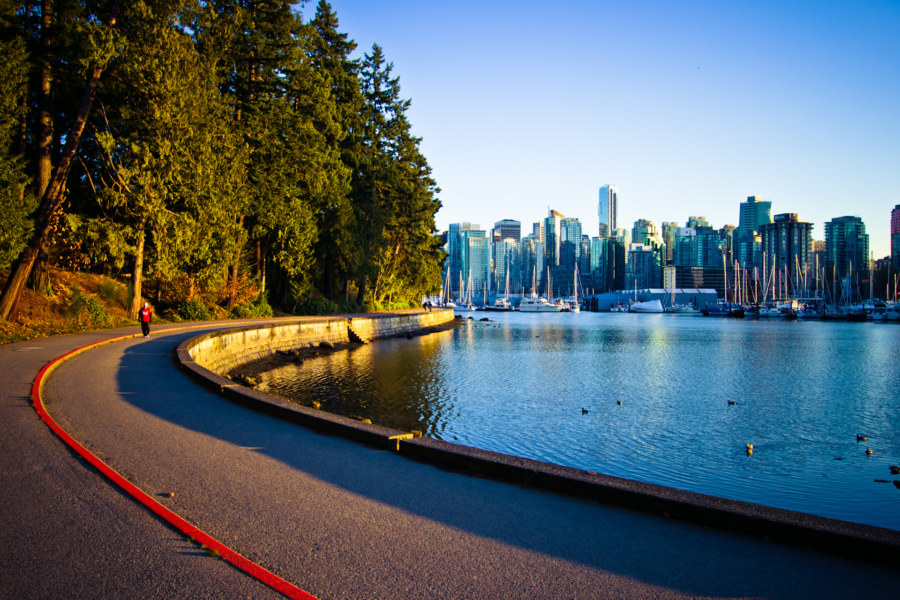
One of the pleasures of living in the West End neighbourhood of Vancouver is that I can easily cycle out to Stanley Park and ride the seawall. I have been doing so regularly, several times a month, despite the deepening cold. Wintertime in Vancouver is toothless compared to what I’ve endured for decades in Toronto. I suppose not everyone feels this way, for the seawall—particularly the far side, beyond the bridge—is virtually empty most of the time. I like it that way.
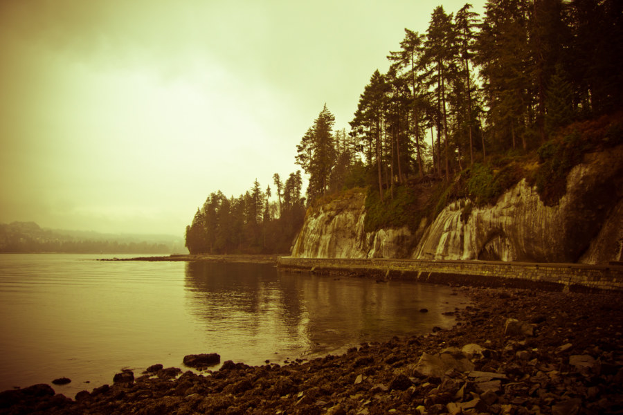
Today I set out for the seawall despite the light dusting of snow on the ground in the West End. I toured the seawall just a few days ago and encountered frost after passing the 9 O’Clock Gun but nothing I saw on that trip prepared me for what I discovered beyond the foot of the Lion’s Gate. Here, rivulets of meltwater cascaded down the cliff-side beneath thick sheets of wind-sculpted ice. Massive icicles dangled precipitously from concave depressions in the rock, occasionally breaking free to clatter down to the thin strip of roadway below.
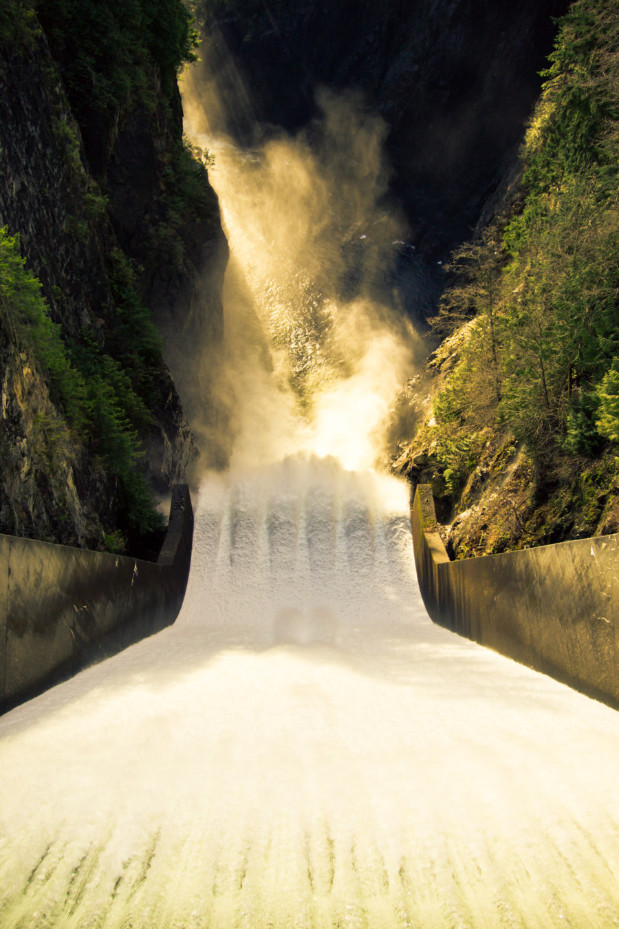
The murky haze and freezing drizzle made shooting photos somewhat challenging. Then again, grey skies are a blank canvas for a Lightroom ninja like me! All but one of the photos below were shot today. The one exception is the final photograph—I captured that one on my sunset ride a few days ago. It might not fit the theme but I can’t restrain myself from sharing it here—Siwash Rock looks beautiful in the dying light.
Capilano Canyon
Seeking to break up the monotony of the work week I took advantage of a supposedly rare dry spell during the Vancouver wet season to voyage down the Capilano River trails from Cleveland Dam. Access to the park is effortless; a city bus crossing the Lion’s Gate bridge delivered me to the park in less than an hour. The lake you see in the photos below is the source of nearly half of the drinking water in the Vancouver region. Presented below are some of the photos I shot on this brief jaunt to the North Shore.
Riding the Seawall in November
I recently moved to the West End neighbourhood of Vancouver. Not long after I began taking advantage of the proximity to Stanley Park to engage in a long-standing Vancouver tradition: riding the seawall. Here are a few photos from my first trip around the park.
Exiled on Koh Phangan
With this set of photos I attempt to capture the feeling of exile I experienced while renting a bungalow outside of Thong Sala for a month. Koh Phangan is a party island but I spent much of my time in solitude not talking with anyone at all. It was a time to rest, to reflect, and to create.