Golden Birds Paradise 金鳥海族樂園

The view from within the abandoned aquarium

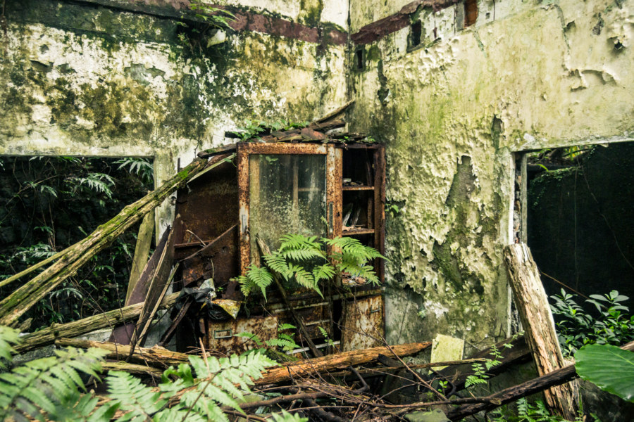
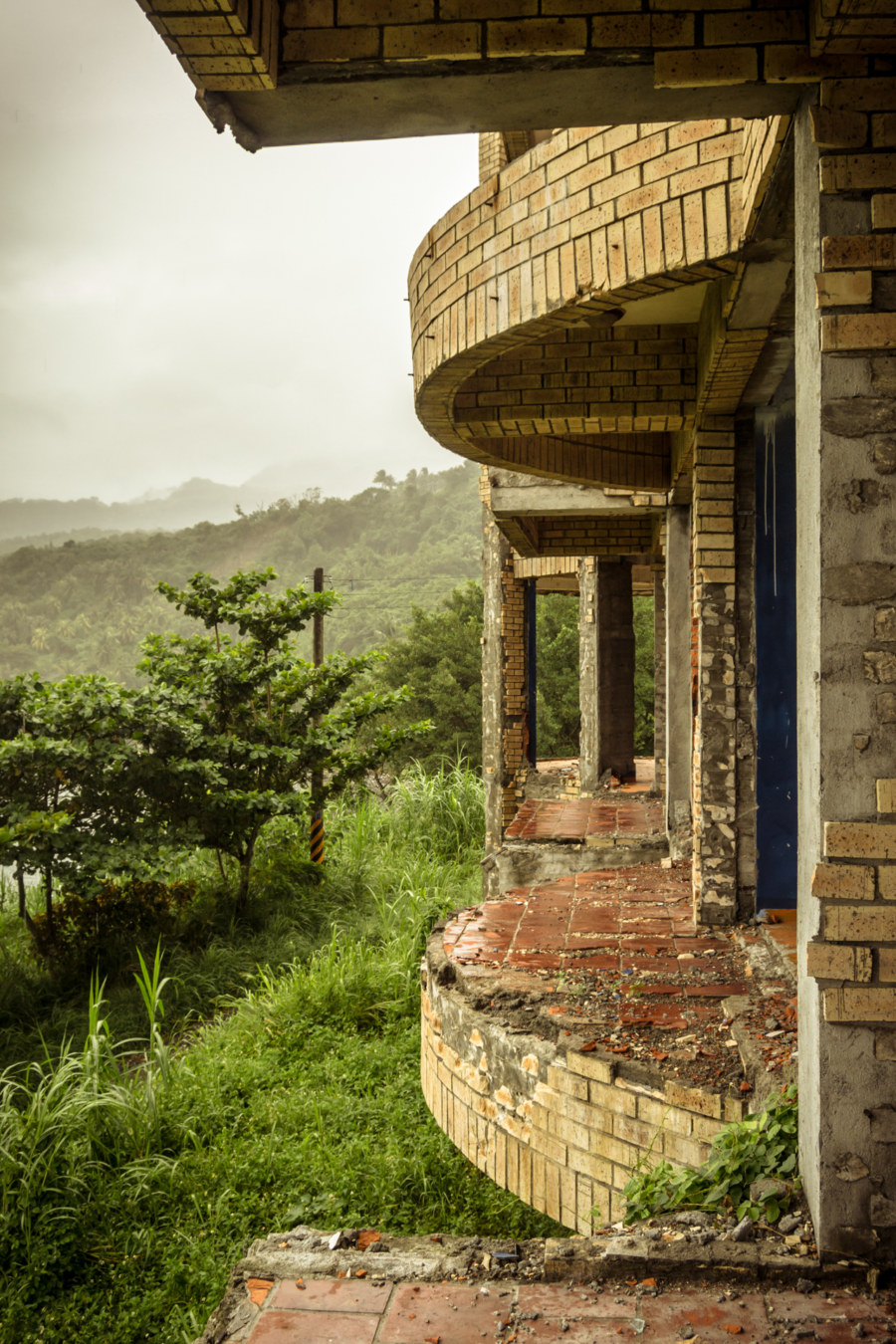
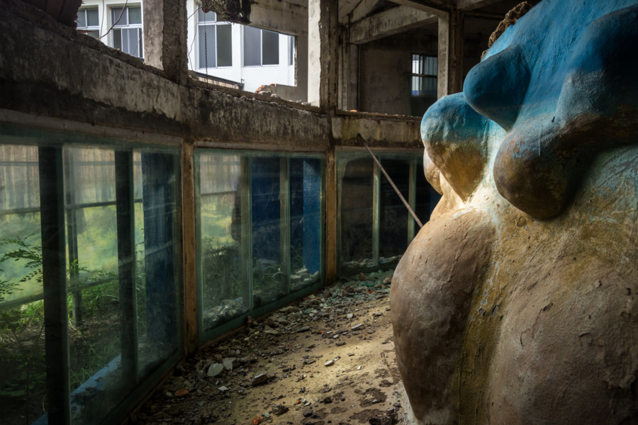
Not long after returning to Taiwan in 2015 I received an invitation from a friend to go road tripping down to Hsinchu to check out an abandoned theme park. Along the way we stopped off to check out a derelict cablecar station and the restored Héxìng Station 合興車站 before arriving at the gateway to Golden Birds Paradise 金鳥海族樂園. Located in the rolling hills of Hsinchu not far from the border Taoyuan, it was among the most extensive and well-known theme parks of northern Taiwan at its peak in the 1990s. Business faltered with the rise of new forms of entertainment in the 2000s and from what I can tell it was completely abandoned nearly a decade ago. Most of the amusement park rides were torn out and probably sold for scrap metal long ago—but many of the original buildings remain, neglected and overgrown.

A Foggy Hike in Yangmingshan 陽明山

Coming down near Xiaoyoukeng

These photographs were taken in early October 2013 while hiking around Yángmíngshān National Park (陽明山國家公園). After meeting up with a friend we took a bus from Jiantan Station in Shilin to Lengshuikeng with the intention of checking out Milk Lake (Niúnǎichí 牛奶湖). Racing up the meandering mountainside roads we soon found ourselves immersed in an interminable fog. Debarking at the bus stop, with hardly another soul around, we decided to wander around and see what we could make of our time in Yangmingshan.

Explorations of the Pacific Edge 1

The easternmost tip of Taiwan

These photos were taken two years ago after cycling through the Old Caoling Tunnel 舊草嶺隧道 into Toucheng, Yilan. The first set of six photos were all shot along the rugged shoreline of the Láilái Geological Area 萊萊地質區 while the last four were captured at Mǎgǎng 馬崗, a half-abandoned fishing village on Cape San Diego 三貂角 (pinyin: Sāndiāojiǎo), the easternmost tip of Taiwan. All were captured in Gongliao. From here the vast Pacific Ocean stretches all the way to Baja California in Mexico.

Ruchuan Village 入船里

Rewilding at the back of Ruchuan Village 入船里

Rùchuán Village 入船里 is a small community in Keelung, a historic port town of approximately 373,000 scattered among the rugged hills of northeastern Taiwan. Keelung’s growth over the last century has been constrained by a lack of flat land on which to build—with much of that concentrated at the foot of the harbour that now constitutes the downtown core. With few other options for expansion the city has sprawled upward along the hillsides and deep into the many valleys leading up from the port.

Jiamuzi Bay Minsu 加母子灣民宿

Nothing left of the glass balconies except an extraordinary view

Jiāmǔzǐ Bay 加母子灣 is a beautifully remote and scenic stretch of coastline just north of Taitung City in Donghe, Taitung. It is also home to the gutted ruins of an abandoned mínsù 民宿 (a funky bed and breakfast or homestay-style inn) readily visible from just about anywhere along the bay. While cruising along the coastal highway on my first Taiwan bicycle tour in late 2013 I stopped two stops to take a closer look: once beneath the moody remnants of Typhoon Usagi and again on a sunny afternoon the following day.

Postcards From Nanfang’ao 南方澳明信片

Returning to Nanfangao harbour

Nánfāng’ào (南方澳) is a major fishing port in Su’ao, Yilan, on the east coast of Taiwan. It is located just south of the end of the Lányáng Plain (蘭陽平原), where a rocky headland juts out into the ocean to form a natural harbour. It opened in 1923 after development by the Japanese colonial authorities and is now considered one of the top fishing ports in the nation, often ranking in third place by measures unknown to me, and is particularly known for its record-breaking mackerel catch. Part of why the port is so productive has to do with the nutrient-rich Kuroshio Current (黑潮, literally “Black Stream”), which lies just offshore.

Crossing the Central Mountain Range of Taiwan 中央山脈機車之旅

Crossing the central mountain range of Taiwan

In the summer of 2014 I was nearing the end of my first sojourn in Taiwan. By the beginning of August I would be in Canada for a wedding in the family with no idea what I’d be doing after that. Since I wasn’t sure if I would be returning to Taiwan I made vague plans to go on a road trip. With only about a week to go before my departure the weather took an ominous turn as Typhoon Matmo 麥德姆 barrelled toward the island. On July 20th, with the pressure of time bearing down on us, my girlfriend and I hopped on a 125cc scooter—the same kind of dinky, puttering scooter you see people riding around any Taiwanese town—and set out from Changhua with the goal of crossing the Central Mountain Range 中央山脈 at Wǔlíng 武陵, the highest paved (and publicly-accessible) mountain pass in Taiwan at 3,275 meters above sea level. With luck, time and weather permitting, we’d be able to visit Héhuānshān 合歡山 and maybe even drive down into the amazingly scenic Taroko Gorge 太魯閣峽谷 on the east side of the island.

The Geographic Center of Taiwan 台灣地理中心

Centrality

The Geographic Center of Taiwan (台灣地理中心) is a modest roadside attraction at Hǔtóushān (虎頭山, literally “Tiger Head Mountain”) in Puli, Nantou, on the way to bigger attractions like Qingjing Farm (清境農場). As the name implies, it marks the geographic center of the island of Taiwan, albeit with a bit of a twist: there are actually two monuments here, one at the base of the mountain and another near the peak at 555 meters above sea level. It’s about a ten minute hike to get to the real center of Taiwan!

Ogon Shrine 黄金神社

Ōgon Shrine foundation

The Ōgon Shrine 黄金神社 (also known as the Gold Temple) is an abandoned Shinto shrine in the mountains above Jīnguāshí 金瓜石, an old gold mining town in Ruifang, Taiwan. Built in 1933 by the Nippon Mining Company while Taiwan was under Japanese rule, it was mostly destroyed in the post-war era by vandals. Even so, it’s in better shape than almost every other Shinto shrine in Taiwan apart from the Taoyuan Martyrs’ Shrine 桃園忠烈祠 and Kagi Shrine 嘉義神社 in Chiayi City. The incoming KMT government went to great lengths to expunge the island of Japanese influences.

Zuoying Lotus Pond 左營蓮池潭

Lotus Pond’s famous dragon and tiger pagodas 龍虎塔

Lotus Pond 蓮池潭 is a manmade lake in Zuoying, Kaohsiung, widely known for its quirky assortment of pagodas, pavilions, and temples. Earlier this year I made a short stop at Lotus Pond on the way to the old walled city of Zuoying a little further south. I like exploring temples in Taiwan but was mildly concerned Lotus Pond would be a bit too touristy for my liking. Turns out I had nothing to worry about; my brief tour of the southwest side of the lake was memorable and fun.